





- Description
- Specifications
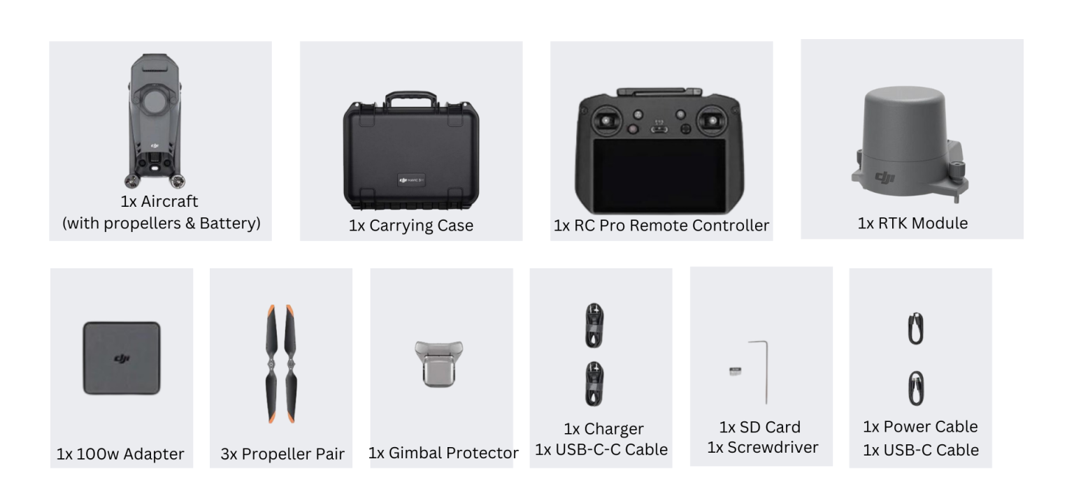
- In The Box
- FAQ's
- Reviews (0)
Description
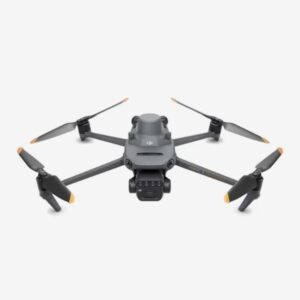
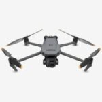
DJI Mavic 3 Multispectral – The Ultimate Drone for Precision Agriculture and Environmental Monitoring
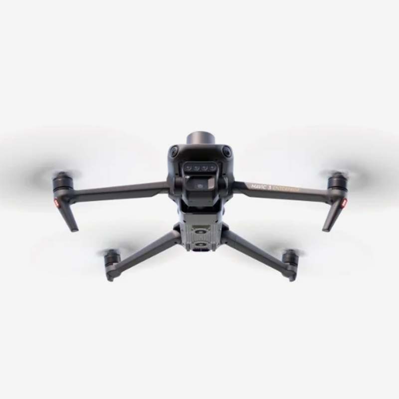
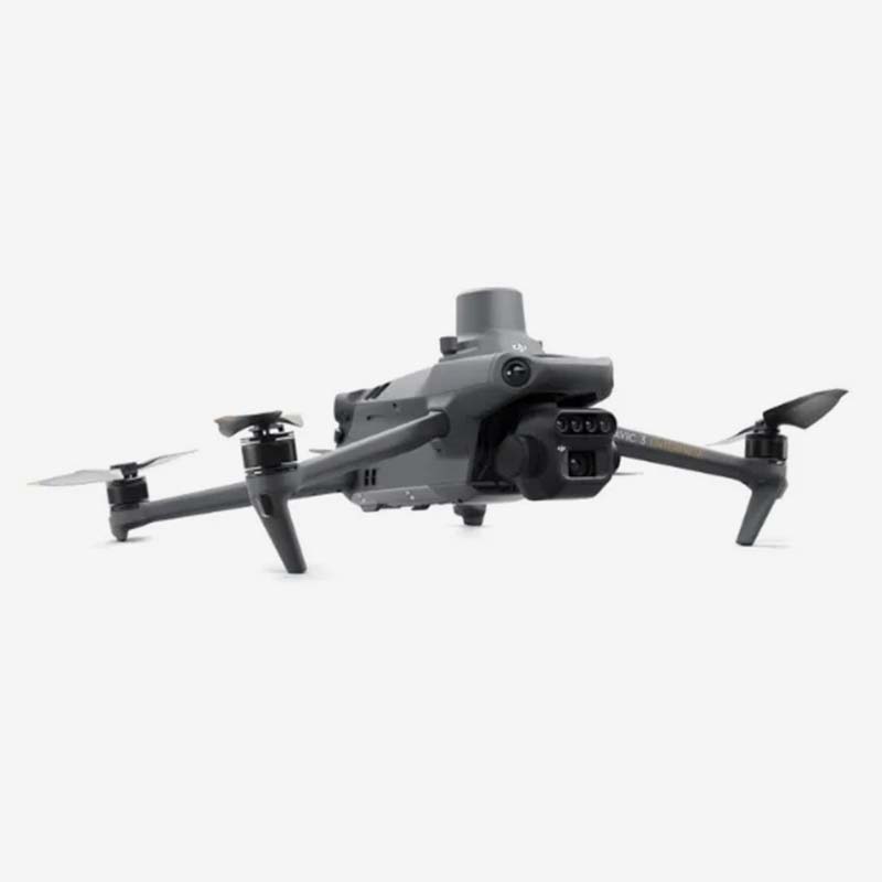
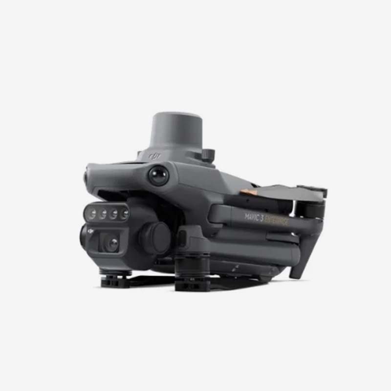
The DJI Mavic 3 Multispectral stands as a groundbreaking tool in the enterprise drone segment, engineered to deliver unmatched precision in aerial data collection. Combining a powerful 20MP 4/3 CMOS RGB camera with advanced multispectral imaging capabilities, this compact yet robust drone empowers professionals to capture both stunning visual detail and critical spectral data in a single flight.
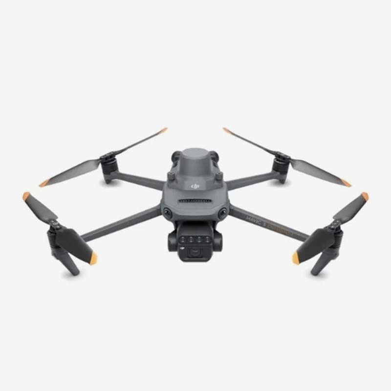
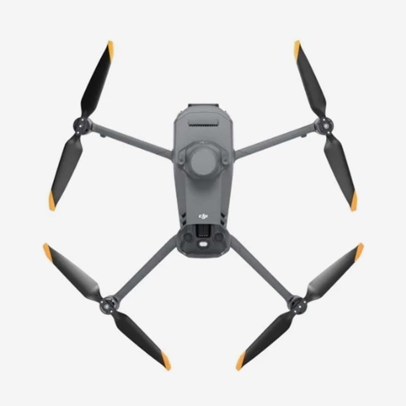
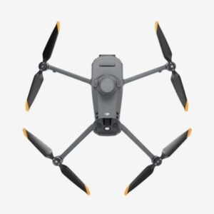
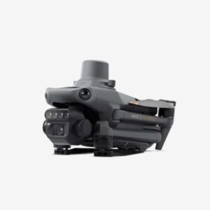
Weighing just 951g with propellers and the RTK module attached, the Mavic 3 Multispectral offers exceptional portability. Its sleek foldable design (223×96.3×122.2 mm folded) makes it easy to transport to remote field locations, while unfolding to 347.5×283×139.6 mm provides stability during demanding operations. With a maximum takeoff weight of 1,050g and impressive wind resistance up to 12 m/s, it performs reliably even in challenging outdoor environments, reaching altitudes up to 6000 meters.
Flight performance is outstanding. Pilots can expect up to 43 minutes of flight time and 37 minutes of stable hovering in calm conditions. The drone supports Normal and Sport modes with maximum speeds of 15 m/s and 21 m/s respectively, giving operators flexibility for both detailed surveying and efficient coverage of large areas. Advanced GNSS support including GPS, Galileo, BeiDou, and GLONASS (with RTK) ensures pinpoint hovering accuracy down to ±0.1m, critical for repeatable data collection missions.
At its heart lies the dual-camera system. The main camera features a 4/3 CMOS sensor with 20MP resolution, 84° FOV, and adjustable aperture from f/2.8 to f/11. It supports 4K video at 30fps and RAW photography, delivering exceptional image quality across various lighting conditions. The integrated multispectral sensors enable precise vegetation index calculations (such as NDVI), early stress detection in crops, soil analysis, and environmental monitoring – transforming raw data into actionable agricultural and ecological insights.
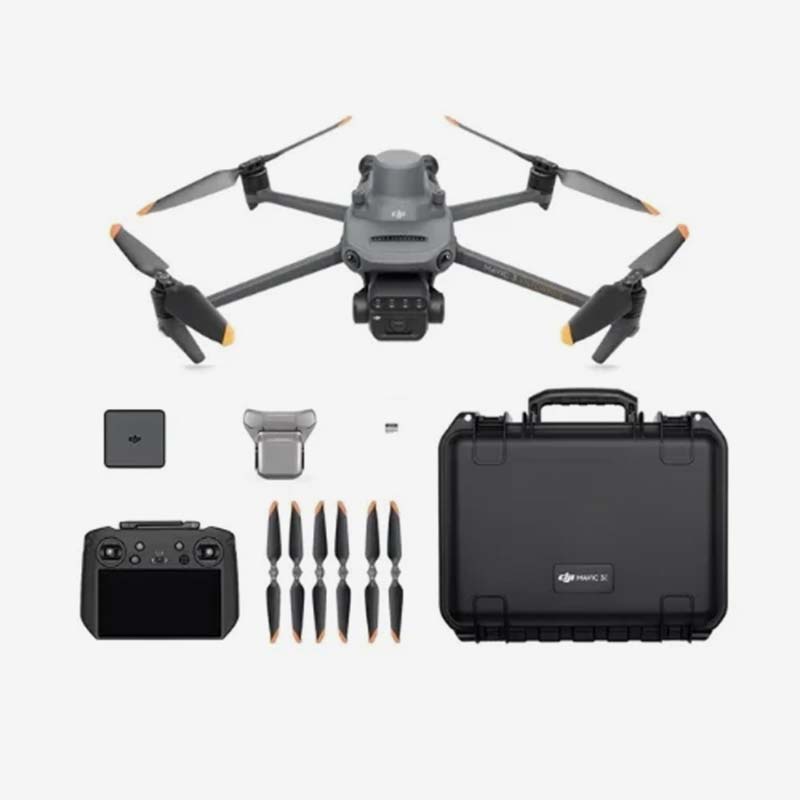
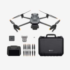
The DJI RC Pro Enterprise controller with O3+ transmission technology provides crystal-clear video feed and responsive control up to 15 km. Built-in safety features, omnidirectional sensing, and intelligent flight modes help ensure secure operations even in complex environments.
Designed for demanding professionals, the Mavic 3 Multispectral excels in precision agriculture for optimizing irrigation and fertilizer use, in forestry for health assessment of large tracts, and in infrastructure projects requiring accurate topographic mapping. Its ability to collect high-resolution RGB and multispectral data simultaneously significantly reduces the need for multiple flights and equipment.
Whether you’re a farmer looking to boost yields, an environmental scientist tracking ecosystem changes, or a surveyor requiring centimeter-level accuracy, the DJI Mavic 3 Multispectral delivers enterprise-grade performance in a remarkably portable package. Invest in the future of aerial intelligence and unlock deeper insights from above with this state-of-the-art multispectral drone solution.
RGB Camera
| Specification | Details |
|---|---|
| Image Sensor | 4/3 CMOS |
| Effective Pixels | 20 MP |
| Lens FOV | 84° |
| Equivalent Focal Length | 24 mm |
| Aperture | f/2.8 to f/11 |
| Focus Range | 1 m to ∞ |
| ISO Range | 100-6400 |
| Shutter Speed | Electronic shutter: 8-1/8000 s Mechanical shutter: 8-1/2000 s |
| Max Image Size | 5280×3956 |
| Photo Shooting Modes | Single shot: 20 MP Timed: 20 MP JPEG: 0.7/1/2/3/5/7/10/15/20/30/60 s JPEG + RAW: 3/5/7/10/15/20/30/60 s Panorama: 20 MP (original material) |
| Video Resolution (H.264) | 4K: 3840×2160 @ 30fps FHD: 1920×1080 @ 30fps |
| Max Video Bitrate | 4K: 130 Mbps FHD: 70 Mbps |
| Supported File System | exFAT |
| Image Format | JPEG / DNG (RAW) |
| Video Format | MP4 (MPEG-4 AVC / H.264) |
Multispectral Camera
| Specification | Details |
|---|---|
| Image Sensor | 1/2.8-inch CMOS |
| Effective Pixels | 5 MP |
| Lens FOV | 73.91° (61.2° x 48.10°) |
| Equivalent Focal Length | 25 mm |
| Aperture | f/2.0 |
| Focus | Fixed Focus |
| Multispectral Bands | Green (G): 560 ± 16 nm Red (R): 650 ± 16 nm Red Edge (RE): 730 ± 16 nm Near Infrared (NIR): 860 ± 26 nm |
| Gain Range | 1x – 32x |
| Shutter Speed | Electronic Shutter: 1/30 – 1/12800 s |
| Max Image Size | 2592 × 1944 |
| Image Format | TIFF |
| Video Format | MP4 (MPEG-4 AVC / H.264) |
| Photo Shooting Modes | Single Shot: 5 MP Timelapse: 5 MP TIFF: 2/3/5/7/10/15/20/30/60 s |
| Video Resolution (H.264) | FHD: 1920 × 1080 @ 30fps |
| Video Content Output | NDVI / GNDVI / NDRE |
| Max Video Bitrate | 60 Mbps |
Gimbal
| Specification | Details |
|---|---|
| Stabilization System | 3-axis mechanical gimbal (tilt, roll, pan) |
| Mechanical Range (Tilt) | -135° to 45° |
| Mechanical Range (Roll) | -45° to 45° |
| Mechanical Range (Pan) | -27° to 27° |
| Controllable Range (Tilt) | -90° to 35° |
| Controllable Range (Pan) | Uncontrollable |
| Max Control Speed (Tilt) | 100°/s |
| Angular Vibration Range | ±0.007° |
Sensing System
| Specification | Details |
|---|---|
| Sensing System Type | Omnidirectional binocular vision system with infrared sensor (bottom) |
| Forward | |
| Distance Measuring Range | 0.5 m to 20 m |
| Detection Range | 0.5 m to 200 m |
| Effective Obstacle Avoidance Speed | Flight Speed ≤15 m/s |
| FOV | Horizontal 90°, Vertical 103° |
| Backward | |
| Distance Measuring Range | 0.5 m to 16 m |
| Effective Obstacle Avoidance Speed | Flight Speed ≤12 m/s |
| FOV | Horizontal 90°, Vertical 103° |
| Lateral | |
| Distance Measuring Range | 0.5 m to 25 m |
| Effective Obstacle Avoidance Speed | Flight Speed ≤15 m/s |
| FOV | Horizontal 90°, Vertical 85° |
| Upward | |
| Distance Measuring Range | 0.2 m to 10 m |
| Effective Obstacle Avoidance Speed | Flight Speed ≤6 m/s |
| FOV | Front and Rear 100°, Left and Right 90° |
| Downward | |
| Distance Measuring Range | 0.3 m to 18 m |
| Effective Obstacle Avoidance Speed | Flight Speed ≤6 m/s |
| FOV | Front and Rear 130°, Left and Right 160° |
| Operating Environment | |
| Forward/Backward/Left/Right/Upward | Surfaces with clear patterns and lighting >15 lux |
| Downward | Diffuse reflective surfaces with >20% reflectivity and lighting >15 lux |
Video Transmission
| Feature | Specification |
|---|---|
| Video Transmission System | DJI O3 Image Transmission Industry Edition |
| Live View Quality | Remote Controller: 1080p/30fps |
| Operating Band [7] | 2.400–2.4835 GHz 5.725–5.850 GHz |
| Max Effective Signal Distance (Unobstructed, No interference) [8] | FCC: 15 km CE: 8 km SRRC: 8 km MIC: 8 km |
| Max Transmission Distance (Obstructed) [9] | Strong Interference (urban landscapes, residential areas): 1.5–3 km (FCC/CE/SRRC/MIC) Medium Interference (suburban landscapes, city parks): 3–9 km (FCC), 3–6 km (CE/SRRC/MIC) Weak Interference (remote fields, open farmland): 9–15 km (FCC), 6–8 km (CE/SRRC/MIC) |
| Max Download Speed | 15 MB/s (with DJI RC Pro Industry Edition) |
| Latency | Approximately 200 milliseconds (depends on environment and mobile device) |
| Antennas | 4 antennas: 2 transmitting, 4 receiving |
| Transmitter Power (EIRP) | 2.4 GHz: <33 dBm (FCC), <20 dBm (CE/SRRC/MIC) 5.8 GHz: <33 dBm (FCC), <30 dBm (SRRC), <14 dBm (CE) |
| Other | Supports the DJI Cellular module |
DJI RC Pro Enterprise Edition
| Specification | Details |
|---|---|
| Image Transmission System | DJI O3 Image Transmission Industry Edition |
| Max Effective Signal Distance (Unobstructed, No interference) | FCC: 15 km CE/SRRC/MIC: 8 km |
| Operating Band of Image Transmission | 2.400–2.4835 GHz 5.725–5.850 GHz |
| Antennas | 4 antennas (2 transmitting, 4 receiving) |
| Transmitter Power (EIRP) | 2.4 GHz: <33 dBm (FCC), <20 dBm (CE/SRRC/MIC) 5.8 GHz: <33 dBm (FCC), <14 dBm (CE), <23 dBm (SRRC) |
| Wi-Fi Protocol | 802.11 a/b/g/n/ac/ax Supports 2×2 MIMO |
| Wi-Fi Operating Bands | 2.400–2.4835 GHz 5.150–5.250 GHz 5.725–5.850 GHz |
| Wi-Fi Transmitter Power (EIRP) | 2.4 GHz: <26 dBm (FCC), <20 dBm (CE/SRRC/MIC) 5.1 GHz: <26 dBm (FCC), <23 dBm (CE/SRRC/MIC) 5.8 GHz: <26 dBm (FCC/SRRC), <14 dBm (CE) |
| Bluetooth Protocol | Bluetooth 5.1 |
| Bluetooth Band | 2.400–2.4835 GHz |
| Bluetooth Transmitter Power (EIRP) | <10 dBm |
| Screen Resolution | 1920×1080 |
| Screen Size | 5.5 inches |
| Screen Frame Rate | 60 fps |
| Screen Brightness | 1,000 nits |
| Touch-Screen | 10-point multi-touch |
| Battery Type | Lithium-ion (5000 mAh, 7.2 V) |
| Charging Type | 100W Battery Charging Hub or USB charger (12V/15V recommended) |
| Rated Power | 12 Watts |
| Storage Capacity | Internal: 64 GB Expandable via microSD card |
| Charging Time | Approx. 1.5 hrs (100W Hub or 15V USB) Approx. 2 hrs (12V USB) Approx. 2 hrs 50 mins (Hub charging drone + RC together) |
| Operating Time | Approx. 3 hours |
| Video Output Port | Mini-HDMI Port |
| Operating Temperature | -10°C to 40°C (14°F to 104°F) |
| Storage Temperature Range | <1 month: -30°C to 60°C 1–3 months: -30°C to 45°C 3–6 months: -30°C to 35°C >6 months: -30°C to 25°C |
| Charging Temperature | 5°C to 40°C (41°F to 104°F) |
| Supported DJI Aircraft | DJI Mavic 3E, Mavic 3T, Mavic 3M |
| GNSS | GPS + Galileo + GLONASS |
| Dimensions | Folded (no sticks): 183.27×137.41×47.6 mm Unfolded (with sticks): 183.27×203.35×59.84 mm |
| Weight | Approx. 680 g |
| Model Number | RM510B |
Storage
| Specification | Details |
|---|---|
| Supported microSD Cards | Please use a memory card with a speed rating of V30 or higher, or use one from the recommended list. |
| Recommended microSD Cards for Remote Controller |
|---|
| SanDisk Extreme PRO 64GB V30 A2 microSDXC |
| SanDisk High Endurance 64GB V30 microSDXC |
| SanDisk Extreme 128GB V30 A2 microSDXC |
| SanDisk Extreme 256GB V30 A2 microSDXC |
| SanDisk Extreme 512GB V30 A2 microSDXC |
| Lexar 667x 64GB V30 A2 microSDXC |
| Lexar High-Endurance 64GB V30 microSDXC |
| Lexar High-Endurance 128GB V30 microSDXC |
| Lexar 667x 256GB V30 A2 microSDXC |
| Lexar 512GB V30 A2 microSDXC |
| Samsung EVO Plus 64GB V30 microSDXC |
| Samsung EVO Plus 128GB V30 microSDXC |
| Samsung EVO Plus 256GB V30 microSDXC |
| Samsung EVO Plus 512GB V30 microSDXC |
| Kingston Canvas Go! Plus 128GB V30 A2 microSDXC |
| Kingston Canvas React Plus 128GB V90 A1 microSDXC |
| Recommended microSD Cards for Aircraft |
|---|
| SanDisk Extreme 32GB V30 A1 microSDHC |
| SanDisk Extreme PRO 32GB V30 A1 microSDHC |
| SanDisk Extreme 512GB V30 A2 microSDXC |
| Lexar 1066x 64GB V30 A2 microSDXC |
| Kingston Canvas Go! Plus 64GB V30 A2 microSDXC |
| Kingston Canvas React Plus 64GB V90 A1 microSDXC |
| Kingston Canvas Go! Plus 128GB V30 A2 microSDXC |
| Kingston Canvas React Plus 128GB V90 A1 microSDXC |
| Kingston Canvas React Plus 256GB V90 A2 microSDXC |
| Samsung PRO Plus 256GB V30 A2 microSDXC |
Battery
| Specification | Details |
|---|---|
| Capacity | 5000 mAh |
| Standard Voltage | 15.4 V |
| Max Charging Voltage | 17.6 V |
| Battery Type | LiPo 4S |
| Chemical System | Lithium Cobalt |
| Energy | 77 watt-hours |
| Weight | 335.5 g |
| Charging Temperature | 5° to 40° C (41° to 104° F) |
Battery Charger
| Specification | Details |
|---|---|
| Input | 100V to 240V (AC), 50Hz to 60Hz, 2.5A |
| Output Power | 100 Watts |
| Output | Maximum output power of 100 Watts (total). When both ports are used, max output of one port is 82 W. Charger dynamically allocates power based on load. |
Charging Hub
| Specification | Details |
|---|---|
| Input | USB-C: 5V to 20V, 5.0A |
| Output | Battery Port: 12V to 17.6V, 8.0A |
| Rated Power | 100 Watts |
| Charging Type | 3 batteries on charging rotation |
| Charging Temperature | 5° to 40° C (41° to 104° F) |
RTK Module
| Specification | Details |
|---|---|
| Dimensions | 50.2 × 40.2 × 66.2 mm (L × W × H) |
| Weight | 24 ± 2 g |
| Interface | USB-C |
| Power | Approximately 1.2 watts |
| RTK Position Accuracy | Fixed RTK: Horizontal: 1 cm + 1 ppm; Vertical: 1.5 cm + 1 ppm |
Other
-
Standard weight of the aircraft (including battery, propellers, and microSD card). The actual product weight may vary due to differences in batch materials and external factors. Use for reference only.
-
The max speed in the EU cannot exceed 19 m/s.
-
Max wind resistance during takeoff and landing.
-
Data measured using the DJI Mavic 3M in a wind-free environment while flying at sea level at a constant speed of 36 kph until there was 0% power remaining. For reference only. Please pay attention to Return to Home prompts in the DJI Pilot 2 app when flying.
-
Data measured using the DJI Mavic 3M in a wind-free environment hovering over sea level until there was 0% power remaining. For reference only. Please pay attention to Return to Home prompts in the DJI Pilot 2 app when flying.
-
Data measured using the DJI Mavic 3M in a wind-free environment while flying at sea level at 57.6 kph until there was 0% power remaining. For reference only. Please pay attention to Return to Home prompts in the DJI Pilot 2 app when flying.
-
In some countries, the 5.1/5.8 GHz frequencies are prohibited, or the 5.1 GHz frequency is only allowed for indoor use. Please refer to local laws and regulations before use.
-
Data measured flying in an unobstructed outdoor environment free of interference. It shows the farthest communication range for one-way, non-Return to Home flights under each standard. Please pay attention to Return to Home prompts in the DJI Pilot 2 app when flying.
-
Data measured in an unobstructed environment with typical interference under various standards. The actual flight distance may vary and is for reference only.
-
The DJI RC Pro will support more DJI aircraft in the future.
2. How long can the DJI Mavic 3 Multispectral fly on a single charge?
It offers up to 43 minutes of maximum flight time and approximately 37 minutes of hover time in no-wind conditions, making it one of the longest-lasting drones in its class for extended missions.
3. Does it come with the RTK module included?
Yes, the net weight specification includes the RTK module, which delivers centimeter-level positioning accuracy essential for professional surveying and mapping work.
4. What industries is this drone best suited for?
It is ideal for precision agriculture, forestry management, environmental conservation, infrastructure inspection, land surveying, and research applications that require both detailed RGB imagery and multispectral data.
5. What is the maximum transmission range?
With the DJI RC Pro Enterprise remote controller and O3+ video transmission system, it supports up to 15 km in ideal conditions.
6. Is the drone suitable for beginners?
While it has intelligent flight modes, the Mavic 3 Multispectral is designed primarily for enterprise and professional users who need advanced imaging capabilities and high precision.
7. What is the current availability and price?
The drone is currently out of stock with a current price of ₹544,999 (incl. GST). Contact us for latest stock updates and delivery timelines.
Be the first to review “DJI Mavic 3 Multispectral”
DJI Matrice 400 Worry-Free Plus Combo
DJI Mavic 3 Enterprise
DJI Mavic 4 Pro Drone with 512GB Creator Combo (DJI RC Pro 2)
Matrice 300 RTK



Reviews
There are no reviews yet.