






- Description
- Specifications
- In The Box
- FAQ's
- Reviews (0)
Description
DJI Matrice M30T – The Ultimate Workhorse for Aerial Professionals
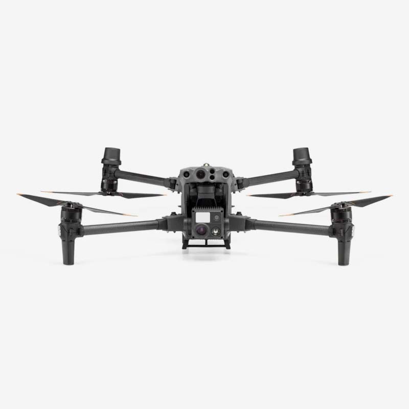
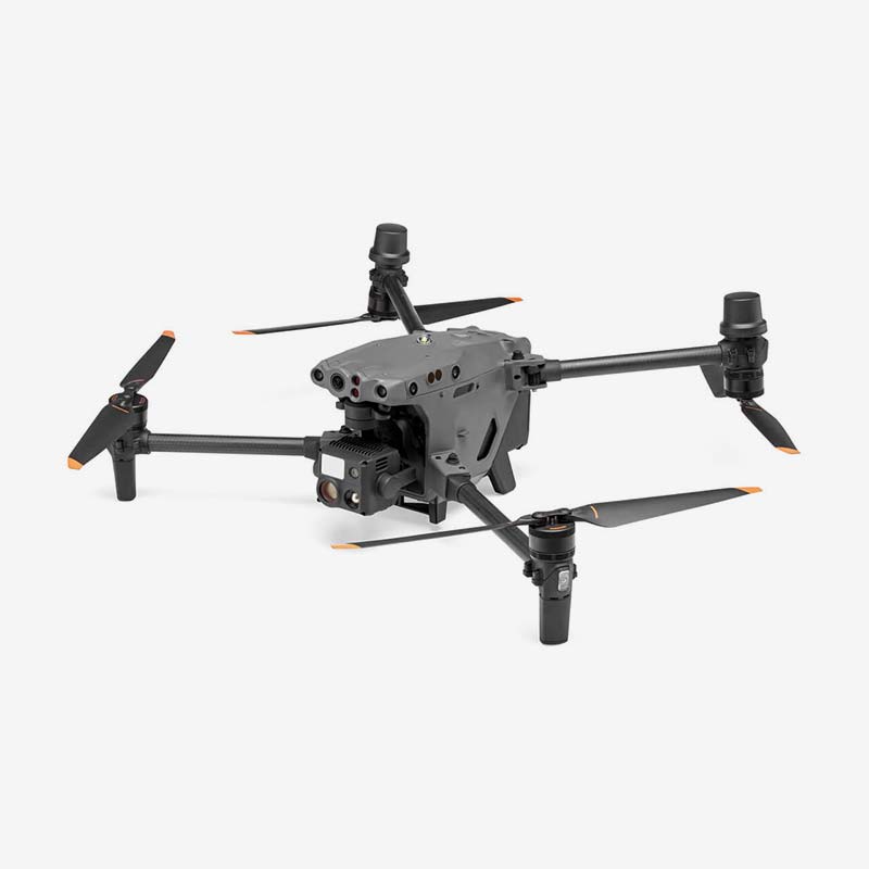
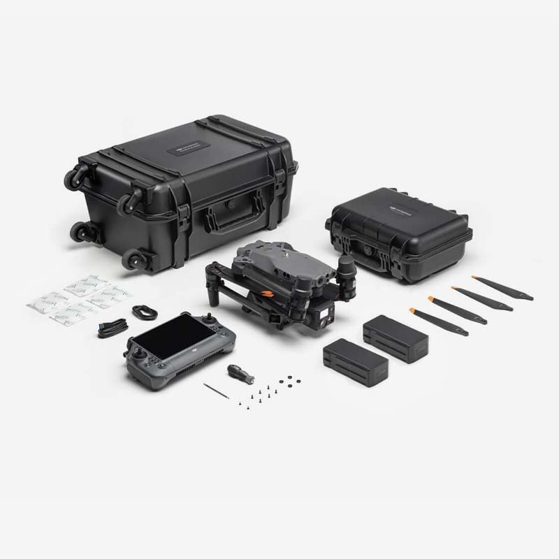
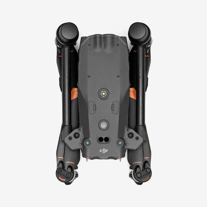
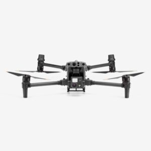
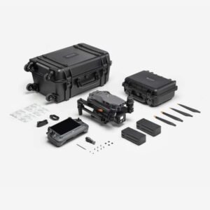
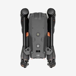
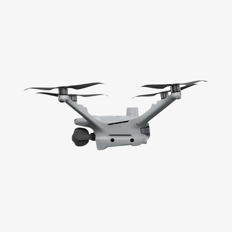
The DJI Matrice M30T is a rugged, all-in-one enterprise drone built for professionals who need reliable performance in the field, whether that’s inspecting infrastructure, mapping large sites, or supporting search-and-rescue operations. Priced at ₹915,999 (inclusive of GST), down from ₹1,200,000, it packs an integrated payload of zoom, wide, and thermal cameras alongside a laser rangefinder into a single, foldable airframe that fits into a backpack-sized case yet unfolds to a full-featured commercial-grade platform.
At its core, the M30T is designed for speed and endurance. It delivers up to 41 minutes of flight time, a top speed of 23 m/s, and wind resistance up to 12 m/s, so operators can complete more coverage per battery cycle even in challenging conditions. With an IP55 ingress protection rating and an operating range of -20°C to 50°C, it is built to withstand rain, dust, and temperature extremes that would ground lesser drones. Its self-heating TB30 batteries, paired with the optional BS30 charging station, bring two batteries from empty to full in roughly 50 minutes, minimising downtime between missions.
The onboard imaging suite is where the M30T truly stands apart. The 48MP zoom camera and 12MP wide camera capture crisp detail from a distance, while the integrated thermal camera (up to 1280×1024 super-resolution) enables night operations, thermal inspections, and search-and-rescue missions. A laser rangefinder with a range of up to 1200 m adds precise distance and coordinate data to every capture, which is invaluable for surveying and asset geolocation. Omnidirectional obstacle sensing, including infrared detection from 0.1 to 38 m, keeps the aircraft safe around structures, towers, and dense terrain.
Connectivity is equally robust. Powered by DJI’s O3 Enterprise transmission system, the M30T maintains a stable link with the 7.02-inch touchscreen remote controller over distances of up to 15 km (FCC), while GPS, Galileo, BeiDou, and optional RTK support deliver centimetre-level positioning accuracy for demanding survey and mapping work. The 3-axis gimbal keeps footage stable even during fast manoeuvres or gusty conditions, ensuring every frame is usable.
Why Choose the DJI Matrice M30T?
- All-in-one payload: zoom, wide, and thermal cameras plus a laser rangefinder, with no need for extra gimbal attachments.
- Rugged, field-ready build with IP55 protection and a -20°C to 50°C operating range for all-weather missions.
- Long endurance: up to 41 minutes of flight time and 23 m/s top speed for covering more ground per flight.
- Fast turnaround with self-heating TB30 batteries and BS30 station charging two batteries in about 50 minutes.
- Reliable, long-range O3 Enterprise transmission up to 15 km with a bright, high-visibility controller display.
- Precision-ready with multi-constellation GNSS and optional RTK for centimetre-accurate positioning and mapping.
- Proven for enterprise use cases: infrastructure inspection, public safety, search and rescue, surveying, and mapping.
Whether you’re managing a fleet for utility inspections, running emergency response operations, or scaling up a surveying business, the DJI Matrice M30T offers a dependable, ready-to-deploy platform that reduces the need for multiple specialised drones — helping teams do more in less time, with fewer trips back to base.
Aircraft
| Specification | Details |
|---|---|
| Dimensions (Unfolded, excl. propellers) | 470×585×215 mm (L×W×H) |
| Dimensions (Folded) | 365×215×195 mm (L×W×H) |
| Diagonal Wheelbase | 668 mm |
| Weight (incl. two batteries) | 3770 ± 10 g |
| Max Takeoff Weight | 4069 g |
| Max Takeoff Weight (C2 Certification, EU) | 3998 g |
| Operation Frequency | 2.4000–2.4835 GHz; 5.725–5.850 GHz |
| Transmitter Power (EIRP) | 2.4 GHz: <33 dBm (FCC); <20 dBm (CE/SRRC/MIC) 5.8 GHz: <33 dBm (FCC/SRRC); <14 dBm (CE) |
| Hovering Accuracy (Windless/Breezy) | Vertical: ±0.1 m (Vision); ±0.5 m (GPS); ±0.1 m (RTK) Horizontal: ±0.3 m (Vision); ±1.5 m (GPS); ±0.1 m (RTK) |
| RTK Positioning Accuracy (Fixed RTK) | Horizontal: 1 cm + 1 ppm Vertical: 1.5 cm + 1 ppm |
| Max Angular Velocity | Pitch: 150°/sec Yaw: 100°/sec |
| Max Pitch Angle | 35° (25° in N-mode with Forward Vision System) |
| Max Ascent Speed | 6 m/s |
| Max Descent Speed | 5 m/s |
| Max Tilt Descent Speed | 7 m/s |
| Max Horizontal Speed | 23 m/s |
| Max Service Ceiling (Above Sea Level) | 5000 m (with 1671 propellers) 7000 m (with 1676 propellers) |
| Max Wind Resistance | 12 m/s |
| Max Hover Time | 36 minutes |
| Max Flight Time | 41 minutes |
| Motor Model | 3511 |
| Propeller Model | 1671 1676 High Altitude (not included) |
| Ingress Protection Rating | IP55 |
| GNSS | GPS + Galileo + BeiDou + GLONASS (GLONASS only with RTK module) |
| Operating Temperature Range | -20° to 50° C (-4° to 122° F) |
| Class (EU) | C2 |
Gimbal
| Angular Vibration Range | ±0.01° |
| Controllable Range | Pan: ±90°Tilt: -120° to +45° |
| Mechanical Range | Pan: ±105°Tilt: -135° to +60°Roll: ±45° |
Zoom Camera
| Specification | Details |
|---|---|
| Sensor | 1/2″ CMOS, Effective pixels: 48MP |
| Lens – Focal Length | 21-75 mm (equivalent: 113-405 mm) |
| Lens – Aperture | f/2.8 – f/4.2 |
| Lens – Focus Range | 5 m to ∞ |
| Exposure Compensation | ±3 EV (using 1/3 EV as step length) |
| Electronic Shutter Speed (Auto – Photo) | 1/8000 – 1/2 s |
| Electronic Shutter Speed (Auto – Video) | 1/8000 – 1/30 s |
| Electronic Shutter Speed (Manual – Photo) | 1/8000 – 8 s |
| Electronic Shutter Speed (Manual – Video) | 1/8000 – 1/30 s |
| ISO Range | 100 – 25600 |
| Max Video Resolution | 3840 × 2160 |
| Max Photo Size | 8000 × 6000 |
Wide Camera
| Specification | Details |
|---|---|
| Sensor | 1/2″ CMOS, Effective pixels: 12MP |
| Lens – DFOV | 84° |
| Lens – Focal Length | 4.5 mm (equivalent: 24 mm) |
| Lens – Aperture | f/2.8 |
| Lens – Focus Range | 1 m to ∞ |
| Exposure Compensation | ±3 EV (using 1/3 EV as step length) |
| Electronic Shutter Speed (Auto – Photo) | 1/8000 – 1/2 s |
| Electronic Shutter Speed (Auto – Video) | 1/8000 – 1/30 s |
| Electronic Shutter Speed (Manual – Photo) | 1/8000 – 8 s |
| Electronic Shutter Speed (Manual – Video) | 1/8000 – 1/30 s |
| ISO Range | 100 – 25600 |
| Max Video Resolution | 3840 × 2160 |
| Max Photo Size | 4000 × 3000 |
Thermal Camera
| Specification | Details |
|---|---|
| Thermal Imager | Uncooled VOx Microbolometer |
| Lens – DFOV | 61° |
| Lens – Focal Length | 9.1 mm (equivalent: 40 mm) |
| Lens – Aperture | f/1.0 |
| Lens – Focus Range | 5 m to ∞ |
| NETD (Noise Equivalent Temperature Difference) | ≤50 mK @ F1.0 |
| Infrared Temperature Measurement Accuracy | ±2°C or ±2% (whichever is larger) |
| Video Resolution | 1280×1024 (Super-resolution), 640×512 (Normal Mode) |
| Photo Size | 1280×1024 (Super-resolution), 640×512 (Normal Mode) |
| Pixel Pitch | 12 µm |
| Temperature Measurement Method | Spot Meter, Area Measurement |
| Temperature Measurement Range | High Gain: -20°C to 150°C (-4°F to 302°F) |
| Low Gain: 0°C to 500°C (32°F to 932°F) | |
| Temperature Alert | Supported |
| Palette Options | White Hot, Black Hot, Tint, Iron Red, Hot Iron, Arctic, Medical, Fulgurite, Rainbow 1, Rainbow 2 |
FPV Camera
| Resolution | 1920×1080 |
| DFOV | 161° |
| Frame Rate | 30 fps |
| Laser Module | |
| Wavelength | 905 nm |
| Max Laser Power | 3.5 mW |
| Single Pulse Width | 6 ns |
| Measurement Accuracy | ± (0.2 m + D×0.15%)D is the distance to a vertical surface |
| Measuring Range | 3-1,200 m (0.5×12 m vertical surface with 20% reflectivity) |
WiFI
| Protocol | Wi-Fi 6 |
| Operating Frequency[1] | 2.4000-2.4835 GHz; 5.150-5.250 GHz; 5.725-5.850 GHz |
| Transmitter Power (EIRP) | 2.4 GHz: <26 dBm (FCC); <20 dBm (CE/ SRRC/MIC)5.1 GHz: <26 dBm (FCC); <23 dBm (CE/ SRRC/MIC)5.8 GHz: <26 dBm (FCC/SRRC); <14 dBm(CE) |
Vision System
| Obstacle Sensing Range | Forward: 0.6-38 mUpward/Downward/Backward/Sideward: 0.5-33 m |
| FOV | 65° (H), 50° (V) |
| Operating Environment | Surfaces with clear patterns and adequate lighting (> 15 lux) |
| Infrared Sensing Systems | |
| Obstacle Sensing Range | 0.1 to 10 m |
| FOV | 30° |
| Operating Environment | Large, diffuse, and reflective obstacles (reflectivity >10%) |
Laser Module
| Specification | Details |
|---|---|
| Wavelength | 905 nm |
| Max Laser Power | 3.5 mW |
| Single Pulse Width | 6 ns |
| Measurement Accuracy | ± (0.2 m + D × 0.15%) (D = distance to vertical surface) |
| Measuring Range | 3 – 1,200 m (with 0.5×12 m vertical surface and 20% reflectivity) |
| Safety Regulation Level | Class 1M |
| Accessible Emission Limit (AEL) | 304.8 nJ |
| Reference Aperture | 18 mm × 18 mm (or 20.3 mm diameter if circular equivalent) |
| Max Laser Pulse Emission Power (within 5 ns) | 60.96 W |
Infrared Sensing Systems
| Specification | Details |
|---|---|
| Obstacle Sensing Range | 0.1 to 10 m |
| Field of View (FOV) | 30° |
| Operating Environment | Large, diffuse, and reflective obstacles (reflectivity >10%) |
TB30 Intelligent Flight Battery
| Specification | Details |
|---|---|
| Capacity | 5880 mAh |
| Voltage | 26.1 V |
| Battery Type | Li-ion 6S |
| Energy | 131.6 Wh |
| Net Weight | Approx. 685 g |
| Operating Temperature | -20° to 50° C (-4° to 122° F) |
| Storage Temperature | 20° to 30° C (68° to 86° F) |
| Charging Temperature | -20° to 40° C (-4° to 104° F) (Auto self-heating activates below 10° C to protect battery health) |
| Chemical System | LiNiMnCoO2 |
Auxiliary Lights
| Effective Illumination Distance | 5 m |
| Illumination Type | 60 Hz, solid glow |
Remote Controller
| Screen | 7.02 inch LCD touchscreen, with a resolution of 1920×1200 pixels, and high brightness of 1200 cd/m2 |
| Internal Battery | Type: Li-ion (6500 mAh @ 7.2 V)Charge Type: Supports battery station or USB-C charger maximum rated power 65W (max voltage of 20V)Charge Time: 2 hours
Chemical System: LiNiCoAIO2 |
| External Battery(WB37 Intelligent Battery) | Capacity: 4920 mAhVoltage: 7.6 VBattery Type: Li-ion
Energy: 37.39 Wh Chemical System: LiCoO2 |
| Operating Time[5] | Internal Battery: Approx. 3 hours 18 minInternal Battery + External Battery: Approx. 6 hours |
| Ingress Protection Rating[3] | IP54 |
| GNSS | GPS+Galileo+BeiDou |
| Operating Temperature | -20° to 50° C (-4° to 122° F) |
O3 Enterprise
| Operating Frequency[1] | 2.4000-2.4835 GHz, 5.725-5.850 GHz |
| Max Transmission Distance (unobstructed, free of interference) | 2.4000-2.4835 GHz: 15 km (FCC); 8 km (CE/SRRC/MIC) |
| Max Transmission Distance (with interference) | Strong Interference (urban landscape, limited line of sight, many competing signals): 1.5-3 km (FCC/CE/SRRC/MIC)Medium Interference (suburban landscape, open line of sight, some competing signals): 3-9 km (FCC); 3-6 km (CE/SRRC/ MIC)Weak Interference (open landscape abundant line of sight, few competing signals): 9-15 km (FCC); 6-8 km (CE/ SRRC/MIC) |
| Transmitter Power (EIRP) | 2.4 GHz: <33 dBm (FCC); <20 dBm (CE/ SRRC/MIC)5.8 GHz: <33 dBm (FCC); <14 dBm (CE); <23 dBm (SRRC) |
Bluetooth
| Protocol | Bluetooth 5.1 |
| Operating Frequency | 2.4000-2.4835 GHz |
| Transmitter Power (EIRP) | <10 dBm |
BS30 Intelligent Battery Station
| Dimensions | 353×267×148 mm |
| Net Weight | 3.95 kg |
| Compatible Battery Type | TB30 Intelligent Flight BatteryWB37 Intelligent Battery |
| Input | 100-240 VAC, 50/60 Hz |
| Output | TB30 Battery Port: 26.1 V, 8.9 A (supported up to two outputs simultaneously)WB37 Intelligent Battery: 8.7 V, 6 A |
| Output Power | 525 W |
| USB-C port | Max. output power of 65 W |
| USB-A port | Max. output power of 10 W (5 V, 2 A) |
| Power Consumption (when not charging battery) | < 8 W |
| Output Power (when warming up battery) | Approx. 30 W |
| Operating Temperature | -20° to 40° C (-4° to 104° F) |
| Ingress Protection Rating[3] | IP55 (with the cover closed properly) |
| Charging Time[6] | Approx. 30 min (charging two TB30 batteries from 20%-90%)Approx. 50 min (charging two TB30 batteries from 0%-100%) |
| Protection Features | Anti-Backflow ProtectionShort Circuit ProtectionOver Voltage Protection
Over Current Protection Temperature Protection |
Other
| Footnotes | [1] 5.8 and 5.1GHz frequencies are prohibited in some countries. In some countries, the 5.1GHz frequency is only allowed for use indoors.[2] The maximum flight time and the hover time were tested in a lab environment and is for reference only.[3] This protection rating is not permanent and may reduce over time after long-term use.
[4] Infrared temperature measurement accuracy was tested in a lab environment and is for reference only. [5] The maximum operating time was tested in a lab environment and is for reference only. [6] The charging time was tested in a lab environment at room temperature. The value provided should be used for reference only. |

How long can the DJI Matrice M30T fly on a single charge?
It offers a maximum flight time of up to 41 minutes and a maximum hover time of up to 36 minutes, depending on operating conditions.
Does the M30T come with a thermal camera?
Yes, it has a built-in thermal camera with resolutions up to 1280×1024 (super-resolution), in addition to a 48MP zoom camera and a 12MP wide camera.
What is the transmission range of the DJI Matrice M30T?
The DJI O3 Enterprise transmission system supports a range of up to 15 km under FCC compliance, using a 7.02-inch touchscreen remote controller.
Is the DJI Matrice M30T weatherproof?
It carries an IP55 ingress protection rating and can operate in temperatures from -20°C to 50°C, making it suitable for rain, dust, and extreme weather conditions.
Does the M30T support RTK for precise positioning?
Yes, it supports GPS, Galileo, and BeiDou by default, with GLONASS and RTK available for centimetre-level accuracy (horizontal 1 cm + 1 ppm, vertical 1.5 cm + 1 ppm) when the RTK module is used.
What industries is the DJI Matrice M30T best suited for?
It is widely used for infrastructure and asset inspection, public safety and search-and-rescue operations, surveying and mapping, and other enterprise applications requiring reliable, all-weather aerial data collection.
Be the first to review “DJI Matrice M30T”
DJI Matrice 400 Worry-Free Plus Combo
DJI Matrice 4E
DJI Matrice 4T



Reviews
There are no reviews yet.