

- Description
- Specification
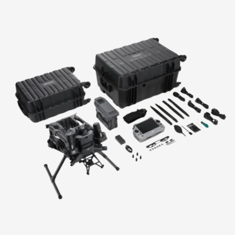
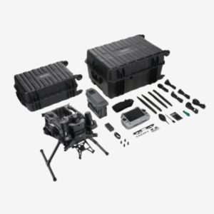
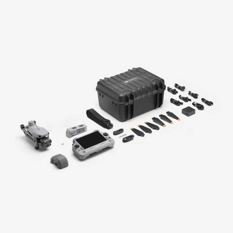
- In The Box
- FAQ's
- Reviews (0)
Description
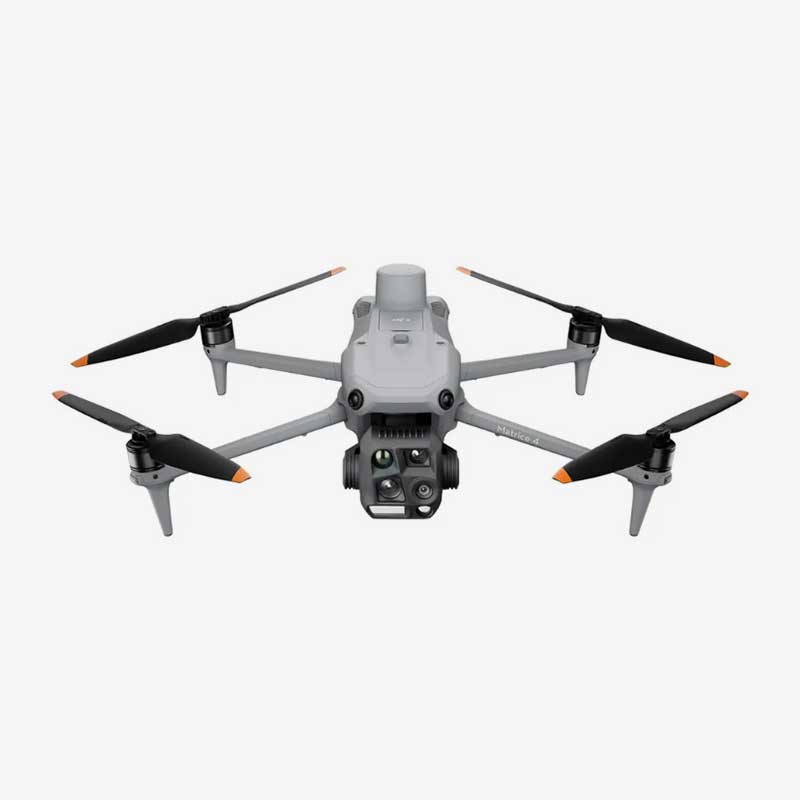
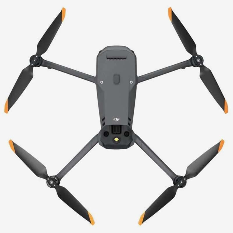
DJI Matrice 400 Worry-Free Plus Combo – Industrial Aerial Excellence, Backed by Elite Protection
The DJI Matrice 400 Worry-Free Plus Combo is the definitive solution for professionals who demand nothing but the highest standards in aerial performance, mission efficiency, and system reliability. Designed for enterprise-level deployment across public safety, energy, construction, mapping, agriculture, and more, this next-generation platform elevates what’s possible in the drone ecosystem.
Combining DJI’s most intelligent flight systems with modular payload compatibility, an ultra-stable transmission system, weather-sealed hardware, and the industry-leading Worry-Free Plus protection plan, the Matrice 400 is engineered to deliver results—whether it’s mapping powerlines, conducting search and rescue in extreme weather, or flying precision surveys in congested environments.
This is more than a drone. It’s a flying command center, a precision data collection tool, and a safety-first platform ready to take on the most complex challenges—all while protecting your investment and minimizing operational downtime.
Key Features Of the DJI Matrice 400 Worry-Free Plus Combo
1. Flight Time – Extended Endurance for Serious Operations
The DJI Matrice 400 delivers a maximum flight time of up to 45 minutes, giving professionals the ability to perform long, uninterrupted missions with confidence. This extended air time is especially useful for tasks that demand large coverage, such as infrastructure inspections, area surveillance, mapping, and search-and-rescue operations. Instead of constantly landing to swap batteries, operators can complete more of the mission in one go, saving time, reducing risk, and improving overall efficiency.
The drone’s flight time depends on various factors like payload weight, wind conditions, and flight speed. However, even with advanced sensors or heavier payloads attached, the Matrice 400 maintains a highly competitive endurance level compared to other enterprise drones. This makes it suitable for industries where flight duration is not just a convenience, but a mission-critical requirement.
2. Battery System – Smart, Dual, and Hot-Swappable Power Solution
Powering the Matrice 400 is DJI’s TB65 dual intelligent battery system, designed to deliver both high performance and reliability. These batteries work together to supply consistent power and are hot-swappable, allowing you to replace one battery while the other keeps the drone powered on. This feature is incredibly valuable for teams that need to minimize downtime, especially during time-sensitive operations.
Each battery is equipped with a smart battery management system that automatically monitors temperature, voltage, charge cycles, and power consumption in real time. This helps prevent overcharging, overheating, and deep discharging, which improves both safety and battery life. The system also offers status alerts through the controller, so pilots always know their remaining power and battery health during flight.
The TB65 batteries are built for rugged environments, capable of performing in extreme temperatures, making them ideal for all-weather missions. With longer cycle life and reliable power output, these batteries support high-demand tasks while keeping operational risks low. For teams managing a fleet, the optional DJI BS65 battery station allows fast, organized charging and transport of multiple batteries, keeping missions moving smoothly without delays.
3. Payload Versatility with Seamless Integration

One of the standout strengths of the Matrice 400 is its extensive payload compatibility. Whether you need high-resolution imaging, thermal inspection, LiDAR scanning, multispectral mapping, or custom sensor integration, the drone supports a broad range of DJI’s official payloads—like the Zenmuse H30, L2, and P1—as well as third-party equipment via the DJI Payload SDK. With the ability to mount single or dual gimbals and even top-mounted configurations, the Matrice 400 adapts to highly specialized workflows across sectors like power grid monitoring, agriculture, firefighting, and more. The seamless integration of payloads through DJI Pilot 2 ensures real-time data viewing, sensor control, and task automation, making this drone truly modular and ready for mission-specific needs.
4. IP55 Industrial-Grade Weather Resistance
Built to operate in the most demanding environments, the DJI Matrice 400 is rated IP55 for water and dust resistance. This means the aircraft can fly safely in light to moderate rain, dusty wind conditions, and industrial zones with particulate exposure. Combined with temperature resilience from -20°C to 50°C, the drone is ideal for year-round operations—from inspecting solar farms under the scorching sun to monitoring flood-prone areas during the monsoon. The sealed chassis, reinforced motors, and corrosion-resistant materials ensure that the drone not only survives but thrives in rugged field conditions where conventional drones would be grounded.
5. Full-Directional Obstacle Avoidance with AI-Powered Precision
The Matrice 400 takes flight safety to the next level with omnidirectional obstacle detection and avoidance, incorporating high-performance vision sensors, infrared sensors, and time-of-flight (ToF) modules. These sensors are strategically placed around the drone to provide 360-degree environmental awareness, allowing it to detect and intelligently avoid buildings, trees, cables, and other hazards in real-time. This full-directional awareness is powered by DJI’s AI algorithms that not only react to obstacles but also predictively reroute paths when necessary. Whether flying low in cluttered urban spaces or close to structures during inspection, the system ensures smooth and safe navigation even under autonomous flight modes.
6. Power-Line-Level Obstacle Sensing – Detects What Others Miss
The DJI Matrice 400 is equipped with advanced Power-Line-Level Obstacle Sensing, designed to detect ultra-thin obstacles such as power lines, telephone wires, and fine cables that are often invisible to the human eye and standard sensors. Using high-precision binocular vision, infrared sensors, and AI-powered recognition, the drone continuously scans its surroundings and identifies even the smallest threats during flight. This feature is crucial when operating in complex environments like power plants, urban infrastructure zones, and communication towers, where one missed wire can cause serious accidents. It works in real time, automatically adjusting the drone’s path to avoid potential collisions—without interrupting the mission. Even in low visibility, light rain, or twilight conditions, the system maintains reliable detection performance. With this technology, operators can confidently fly closer to obstacles with greater safety and precision, reducing risks and ensuring mission success in the most demanding scenarios.
7. Smart AR Projection
1. Power Line AR – Make the Invisible Visible
Power Line AR is designed to solve one of the most critical challenges in drone operations: detecting thin, nearly invisible power lines. Using AI recognition and preloaded utility data, this feature overlays a visual representation of power lines directly onto the live camera feed of the drone. This becomes especially useful during inspections, disaster response, or night missions when visibility is compromised. Instead of relying on human vision alone, Power Line AR ensures that pilots are constantly aware of the location of every wire in the area, significantly reducing the risk of collision and enabling safer, more confident close-range operations near power infrastructure.
2. Map View AR – Real-Time Augmented Reality on Mission Maps
Map View AR transforms a standard 2D map into a live 3D awareness tool by overlaying the drone’s flight data, obstacle alerts, and mission paths in real time. Pilots can see a live AR representation of the aircraft’s movement, upcoming waypoints, no-fly zones, or terrain elevations without switching between screens or interfaces. This augmented map enhances situational awareness by combining real-world orientation with mission data, allowing for better decision-making. It’s especially useful in large-area missions, multi-drone operations, or when flying in unfamiliar or GPS-dense environments like cities or mountainous regions.
3. AR Flight Waypoint – Visualized Flight Paths for Safer Missions
AR Flight Waypoint gives pilots the ability to preview and monitor their entire planned flight path as a series of projected digital markers visible through the drone’s FPV camera. Instead of only relying on the controller’s map, this feature lets you see where the drone will go—right in the sky—before or during flight. This allows teams to verify the safety and efficiency of the route visually, identify nearby obstacles in advance, and make live corrections if needed. It’s a game-changer for precision work like automated inspections, repeatable survey missions, or flights in confined airspace.
4. Live Annotations – Real-Time Notes for Instant Collaboration
Live Annotations allow operators to draw, pin, or mark points of interest directly onto the live video feed or the map view—while the drone is in flight. For example, if a crack is spotted on a transmission tower or a fallen tree is seen during a search mission, the operator can instantly drop a marker on that location. These annotations are saved with GPS coordinates and can be shared across multiple team members in real time. This feature greatly improves communication, enhances coordination with ground teams, and supports faster decision-making without interrupting the flight.
Application Scenarios

Dos and Don’ts
Do’s:
Conduct pre-flight checks before every mission
Log all flights and maintenance for fleet tracking
Use only DJI-certified accessories and payloads
Fly with at least two trained personnel for field ops
Use Pilot 2’s geofencing and obstacle preview tools
Don’ts:
Do not fly near unapproved no-fly zones or restricted areas
Never use unbalanced or third-party batteries
Avoid flying in heavy rainfall or thunderstorms
Do not ignore alerts for sensor calibration or firmware updates
Avoid overloading the payload bay beyond DJI’s limits
Safety Features
Redundant Flight Systems: Dual IMUs, barometers, and compass modules ensure failover capability in the event of system failure.
Smart RTH and Emergency Brake: Automatically returns to home point or hovers on command or signal loss.
ADS-B Receiver: Detects nearby manned aircraft to enhance airspace awareness and reduce mid-air risks.
360° Obstacle Sensing: Multi-sensor fusion ensures real-time object detection, with auto-braking or rerouting capabilities.
Encrypted Data Links: All data transmission is protected by enterprise-grade AES-256 encryption for mission security.
Why Choose Us – Your Trusted Drone Technology Partner
Expert Guidance from Industry Professionals
Our team understands the real-world challenges of industries like inspection, surveying, public safety, agriculture, and cinematography. We offer expert recommendations tailored to your specific mission requirements.100% Genuine DJI Products with Warranty Assurance
We source all products directly from authorized DJI channels, ensuring original hardware, valid warranties, and full compatibility with DJI’s latest updates and accessories.Thorough Pre-Dispatch Quality Checks
Each drone is carefully inspected, firmware-updated, and tested for packaging integrity before it leaves our facility, so you receive a fully functional unit, ready to fly.Dedicated Technical Support & Onboarding
Whether you’re a beginner or a seasoned operator, we provide personalized setup assistance, technical guidance, and after-sales support to help you get the most from your equipment.Fast Shipping & GST-Compliant Invoicing
We ensure quick and secure delivery across India, along with GST invoices and complete purchase documentation for individuals and businesses.Priority Support for Enterprise & Government Clients
We understand the urgency of professional operations and offer dedicated service channels and fast turnaround for B2B and institutional buyers.End-to-End Customer Service
From product selection to training and post-purchase care, we’re committed to building long-term relationships, not just making one-time sales.Real-Time Communication & Transparent Process
You’ll never be left guessing—we provide timely updates, honest information, and responsive communication at every stage of your order.
Large Specification of DJI Matrice 400 Worry-Free Plus Combo
Aircraft
| Category | Specification |
|---|---|
| Takeoff Weight (with propellers) | Without Batteries: 5020 ± 20 g With Batteries: 9740 ± 40 g <small>(Actual product weight may vary due to batch materials and external factors)</small> |
| Max Takeoff Weight | 15.8 kg |
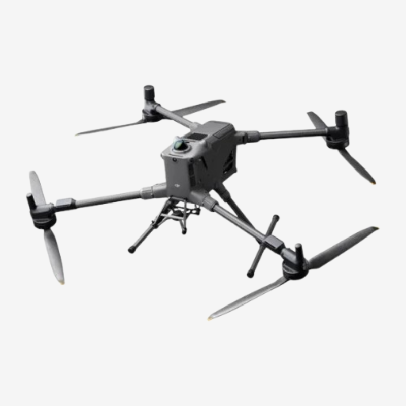
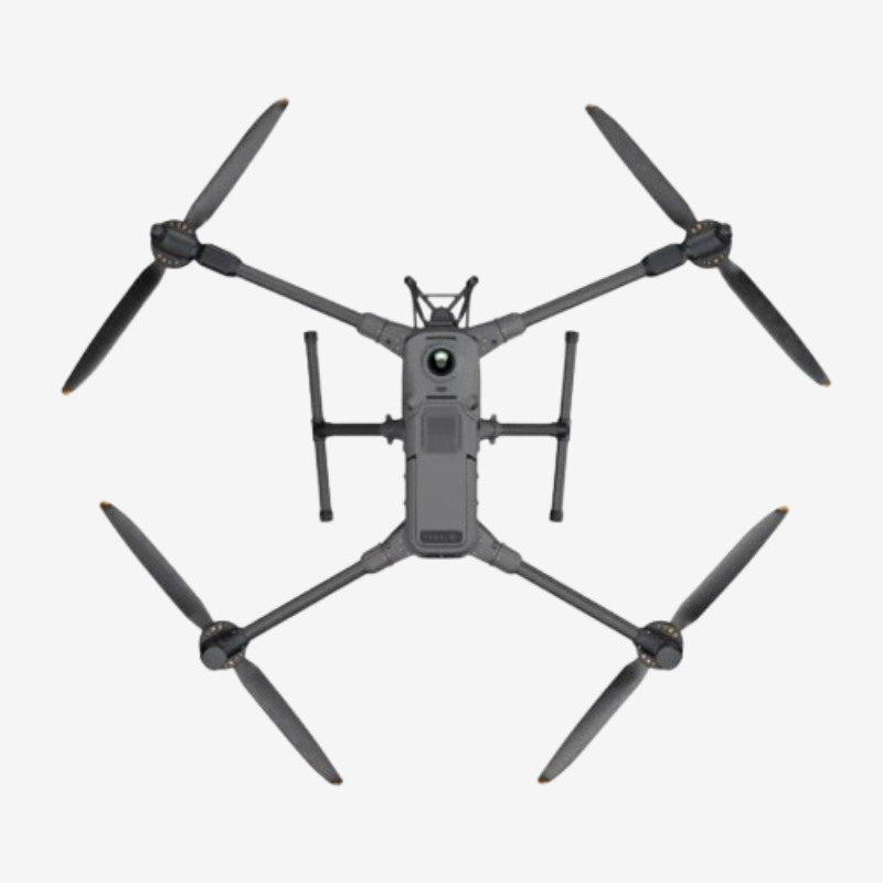
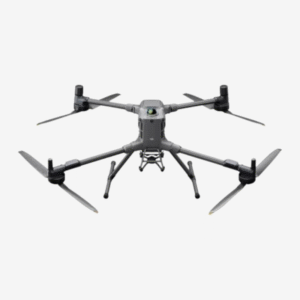
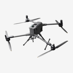
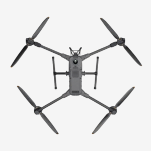
| Dimensions | Unfolded: 980×760×480 mm (L×W×H) (with landing gear) Folded: 490×490×480 mm (with landing gear and gimbal) Aircraft Carrying Case: 779×363×528 mm |
| Max Payload | 6 kg <small>(Measured at third gimbal connector under sea level. Capacity decreases with altitude. Refer to manual.)</small> |
| Propeller Size | 25 inches |
| Diagonal Wheelbase | 1070 mm |
| Max Ascent Speed | 10 m/s |
| Max Descent Speed | 8 m/s |
| Max Horizontal Speed | 25 m/s (at sea level, no wind) |
| Max Takeoff Altitude | 7000 m |
| Max Flight Time (no wind) | 59 minutes <small>(Measured at 10 m/s with H30T @10,670 g, 100% to 0%)</small> |
| Max Hover Time (no wind) | 53 minutes <small>(Hovering with H30T, 100% to 0%)</small> |
| Max Flight Distance | 49 km <small>(At 17 m/s, no payloads, 100% to 0%)</small> |
| Max Wind Resistance | 12 m/s (takeoff and landing) |
| Max Yaw Angular Velocity | 100°/s |
| Max Pitch Angle | 35° |
| Operating Temperature | -20° to 50° C (-4° to 122° F) |
| GNSS | GPS + Galileo + BeiDou + GLONASS* <small>(*GLONASS only with RTK module)</small> |
| ADS-B In | Yes (airborne receiver with dual antennas) Reception Range: Up to 20 km |
| Hovering Accuracy | Vertical: ±0.1 m (vision), ±0.5 m (satellite), ±0.1 m (RTK) Horizontal: ±0.3 m (vision), ±0.5 m (satellite), ±0.1 m (RTK) |
| RTK GNSS Accuracy | RTK Fix: 1 cm + 1 ppm (H), 1.5 cm + 1 ppm (V) RTK Heading Accuracy: < 2° |
| Internal Storage | N/A |
| Ports | USB-C Debug Port × 1 (USB 2.0) E-Port V2 × 4 (120 W per port) Cellular Dongle 2 Interface × 2 |
| Propeller Model | 2510F |
| Beacon | Built-in |
| Ingress Protection Rating | IP55 <small>(May reduce with wear over time)</small> |
Gimbal Specifications
| Feature | Specification |
|---|---|
| Maximum Payload for Single Gimbal Connector | 1400 g |
| Note | If exceeded, the gimbal damper’s lifespan will decrease from 1000 hours to 400 hours |
| Maximum Payload for Dual Gimbal Connector | 950 g |
| Maximum Payload for Third Gimbal Connector | 3 kg (quick-release port), 6 kg (screw lock fastening) |
Sensing Specifications
| Sensor Type | Specification |
|---|---|
| Sensing Type | Omnidirectional binocular vision (full-color fisheye) + Horizontal rotating LiDAR + Upper LiDAR + Downward 3D infrared sensor + Six-direction mmWave radar |
| Forward Sensing | Measurement: 0.4–21 m Detection: 0.4–200 m FOV: 90° (H), 90° (V) |
| Backward Sensing | Measurement: 0.4–21 m Detection: 0.4–200 m FOV: 90° (H), 90° (V) |
| Lateral Sensing | Measurement: 0.6–21 m Detection: 0.5–200 m FOV: 90° (H), 90° (V) |
| Downward Sensing | Measurement: 0.5–19 m FOV: 160° (front/rear), 105° (left/right) |
| Operating Environment | All Directions: Surfaces with delicate textures & adequate light Downward: Rich textures, >20% reflectivity, well-lit (at least city street lighting at night) |
| Rotating LiDAR | Range: 0.5–100 m @ 100,000 lux (10% reflectivity) Power Line Detection: 35 m @ 30° @ 10,000 lux (21.6 mm wire) FOV: 360° (H), 58° (V) Point Frequency: 520,000 pts/s Laser Wavelength: 905 nm Eye Safety: Class 1 (IEC60825-1:2014) |
| Upper LiDAR (3D ToF) | Range: 0.5–25 m at night (reflectivity >10%) FOV: 60° (H), 60° (V) |
| Downward 3D IR Sensor | Range: 0.3–8 m (reflectivity >10%) FOV: 60° (front/rear), 60° (left/right) |
| mmWave Radar | Power Line Detection: 36 m (12.5 mm wire), 50 m (21.6 mm wire) FOV: ±45° (H & V) Note: Not available in all regions |
FPV Camera Specifications
| Feature | Specification |
|---|---|
| Resolution | 1080p |
| DFOV (Diagonal) | 150° |
| HFOV (Horizontal) | 139.6° |
| VFOV (Vertical) | 95.3° |
| Frame Rate | 30 fps |
| Night Vision | Starlight-grade |
Video Transmission Specifications
| Feature | Specification |
|---|---|
| Video Transmission System | DJI O4 Enterprise Enhanced Video Transmission System |
| Live View Quality | Remote Controller – 3-channel 1080p/30fps |
| Operating Frequency & Transmitter Power (EIRP) | |
| 902–928 MHz | < 30 dBm (FCC), < 16 dBm (MIC) |
| 1.430–1.444 GHz | < 35 dBm (SRRC) |
| 2.4000–2.4835 GHz | < 33 dBm (FCC), < 20 dBm (CE/SRRC/MIC) |
| 5.150–5.250 GHz | < 23 dBm (FCC/CE) |
| 5.725–5.850 GHz | < 33 dBm (FCC), < 14 dBm (CE), < 30 dBm (SRRC) |
| Note | Frequencies vary by region. Always follow local regulations. |
| Max Transmission Distance (Unobstructed, No Interference) | |
| FCC | 40 km |
| CE/SRRC/MIC | 20 km |
| Max Transmission Distance (With Interference) | |
| Strong Interference | approx. 1.5–6 km |
| Medium Interference | approx. 6–15 km |
| Weak Interference | approx. 15–40 km |
| Max Download Speed | |
| Standard Mode | 80 Mbps Downlink |
| Playback Download | < 25 MBps |
| Single-Channel Bitrate | ≤ 12 Mbps |
| Antenna Configuration | |
| WLAN Antennas | 8 (6 vertical, 2 horizontal) |
| Sub2G Antennas | 2 (vertical) |
| 4G Antennas | 4 |
| Operating Mode | 2T4R |
| Others | Supports Dual Control Mode and 2-channel Cellular Dongle 2 |
Battery Specification
| Battery Specification | Details |
|---|---|
| Model | TB100 |
| Capacity | 20254 mAh |
| Standard Voltage | 48.23 V |
| Max Charging Voltage | 54.6 V |
| Cell Type | Li-ion 13S |
| Energy | 977 Wh |
| Weight | 4720 ± 20 g |
| Charging Temperature | 5° to 45° C (41° to 113° F) |
| Discharging Temperature | -20° to 75° C (-4° to 122° F) |
| Battery Heating | Single Battery: Support Onboard: Support Battery Station: Support |
| Discharge Rate | 4C |
| Max Charging Power | 2C |
| Low-Temperature Charging | Supports low-temperature self-heating charging |
| Cycle Count | 400 |
Intelligent Battery Station
| Specification | Details |
|---|---|
| Model | BS100 |
| Net Weight | 11.8 kg |
| Dimensions | 605 × 410 × 250 mm (L × W × H) |
| Supported Batteries | TB100 Intelligent Flight Battery, TB100C Tethered Battery, WB37 Battery |
| Operating Temperature | -20° to 40° C (-4° to 104° F) |
| Input | 100-240 V (AC), 50-60 Hz, 10 A |
| Output – TB100 Interface | 100-110 V: Approx. 1185 W 110-180 V: Approx. 1474 W 180-240 V: Approx. 2184 W |
| Output – WB37 Interface | 100-240 V: Approx. 52 W |
| Output – USB-C | 5.0V 3.0A, 9.0V 3.0A, 12.0V 3.0A, 15.0V 3.0A, 20.0V 3.25A |
| Number of Charging Channels | 3 × TB100 and 2 × WB37 batteries |
| Charging Mode | Ready-to-Fly Mode: 90% Standard Mode: 100% Supports Fast & Silent Modes |
| Charging Time (220V) | Fast Mode: 45 mins Silent Mode: 110 mins |
| Charging Time (110V) | Fast Mode: 70 mins Silent Mode: 110 mins |
| Note | Charging time tested at 25° C temperature |
DJI RC Plus 2 Enterprise Enhanced
| Feature | Specification |
|---|---|
| Model | TKPL 2 |
| System Version | Android 11 |
| Supported Aircraft | Matrice 400 |
| Video Transmission | DJI O4 Enterprise Enhanced Video Transmission System |
| Max Transmission Distance | 40 km (FCC), 20 km (CE/SRRC/MIC) |
| Operating Frequency & EIRP | 902-928 MHz: < 30 dBm (FCC), < 16 dBm (MIC) 2.400–2.4835 GHz: < 33 dBm (FCC), < 20 dBm (CE/SRRC/MIC) 5.150–5.250 GHz: < 23 dBm (FCC/CE) 5.725–5.850 GHz: < 33 dBm (FCC), < 14 dBm (CE), < 30 dBm (SRRC) |
| Antenna System | 2T4R, 2.4GHz/5.8GHz multi-beam high-gain antenna |
| Sub2G Module | 2T2R |
| Enhanced Transmission Support | Supports DJI Cellular Dongle 2 |
| Wi-Fi Protocol | Wi-Fi Direct, Wireless Display, IEEE 802.11 a/b/n/ac/ax, 2×2 MIMO, Dual Band, Dual MAC, up to 1774.5 Mbps |
| Wi-Fi Operating Frequency | 2.400–2.4835 GHz 5.150–5.250 GHz 5.725–5.850 GHz |
| Wi-Fi Transmitter Power (EIRP) | 2.4 GHz: < 26 dBm, < 20 dBm (CE/SRRC/MIC) 5.1 GHz: < 23 dBm (FCC/CE/SRRC/MIC) 5.8 GHz: < 23 dBm (FCC/SRRC), < 14 dBm (CE) |
| Bluetooth Version | Bluetooth 5.2 |
| Bluetooth Frequency | 2.400–2.4835 GHz |
| Bluetooth EIRP | < 10 dBm |
| Screen Size | 7.02 inches |
| Resolution | 1920 × 1200 |
| Frame Rate | 60fps |
| Brightness | 1400 nits |
| Touchscreen | 10-point multi-touch |
| Internal Battery | 2S2P Li-ion (6500 mAh @ 7.2V), 46.8 Wh |
| External Battery | Optional, WB37 (4920 mAh @ 7.6V), 37 Wh |
| Charging Type | Supports PD fast charging (max 20V/3.25A via USB-C) |
| Charging Time | 2 hrs (internal), 2 hrs (internal + external), measured with device off and standard charger |
| Battery Runtime | Internal: 3.8 hrs, External: 3.2 hrs |
| Storage | 8GB RAM + 128GB ROM (UFS) + microSD expandable |
| Output Port | HDMI 1.4 |
| External Interfaces | HDMI 1.4, SD 3.0, USB-C (OTG, PD charging), USB-A (USB 2.0) |
| Indicators | Status LED, battery level LED, connection status LED, tricolor light (auto brightness) |
| Audio & Speaker | Array MIC, buzzer supported |
| Operating Temperature | -20°C to 50°C (-4°F to 122°F) |
| Storage Temperature | Up to 1 month: -30°C to 45°C 1–3 months: -30°C to 35°C 3–12 months: -30°C to 30°C |
| Charging Temperature | 5°C to 40°C (41°F to 104°F) |
| GNSS | GPS + Galileo + BeiDou |
| Dimensions (L×W×H) | 268 × 163 × 94.5 mm |
| Weight | 1.15 kg (without external battery) |
| Accessories | Strap, waist support |
Supported Products
| Category | Products |
|---|---|
| Gimbal Cameras | Zenmuse H30, Zenmuse H30T, Zenmuse L2, Zenmuse P1 |
| Accessories | Zenmuse S1 (drone spotlight), Zenmuse V1 (drone speaker), Manifold 3, DJI RC Plus 2 sub2G SDR Module, DJI Cellular Dongle 2 |
| RTK Stations | D-RTK 3 Multifunctional Station, D-RTK 2 Mobile Station |
| Ecosystem Accessories | DJI X-Port, DJI E-Port V2 Development Kit, DJI E-Port V2 Coaxial Cable Kit, DJI SKYPORT V3 Adapter Set, DJI SKYPORT V3 Coaxial Cable Kit |

What is the ingress protection (IP) rating of DJI Matrice 400? Can I fly the drone in the rain?
DJI Matrice 400 has an IP55 rating, which provides protection against limited dust ingress and low-pressure water jets. However, it is not recommended to fly in rainfall heavier than 100 mm within 24 hours. Please note, the IP rating may degrade over time due to wear and tear.
What does the sensing system of DJI Matrice 400 consist of?
The drone includes a comprehensive obstacle sensing system:
- Omnidirectional binocular vision system
- Downward-facing binocular vision system
- Horizontal rotating LiDAR
- Upward LiDAR
- Downward 3D infrared range sensor
- 6-directional mmWave radar
How is the obstacle avoidance capability of DJI Matrice 400?
The Matrice 400 offers excellent power line detection:
- When facing main power lines (21.6 mm steel-core aluminum), detection is effective at speeds up to 25 m/s
- With both main and distribution lines (12 mm), detection works up to 17 m/s
Note: Obstacle detection performance can be affected by conditions like fog, rain, cloud, or snow. The system does not actively avoid fast-moving objects. Also, mmWave radar is not available in some countries/regions.
How is the payload capacity of DJI Matrice 400?
The third gimbal connector supports a maximum payload of 6 kg.
If you’re using multiple gimbals simultaneously (single downward, dual downward, and third gimbal), the total non-DJI payload must not exceed 6 kg. Always ensure the payload is tested by the manufacturer for safety, especially under low battery conditions.
Does DJI Matrice 400 support dual batteries or a single battery?
DJI Matrice 400 supports only a single battery.
How do I activate DJI Matrice 400?
Without 4G dongle (SIM card included), how can I use Network RTK services with DJI Matrice 400?
Simply use Wi-Fi on the remote controller to connect to the internet and access Network RTK services without needing a 4G dongle.
Are Network RTK services of DJI Matrice 400 bound to the remote controller or the aircraft?
The Network RTK services are bound to the remote controller, not the aircraft.
Does DJI Matrice 400 support quick start?
Yes, the DJI Matrice 400 features a built-in capacitor that offers backup power to essential components. If you replace the battery within 45 seconds, the aircraft can resume operation immediately without needing to reboot the entire system.
Which payloads and accessories are compatible with DJI Matrice 400?
DJI Matrice 400 supports a wide range of payloads and accessories as listed below:
Gimbal Cameras:
Zenmuse H30, Zenmuse H30T, Zenmuse L2, Zenmuse P1Functional Accessories:
Zenmuse S1 Spotlight, Zenmuse V1 Speaker, Manifold 3, DJI RC Plus 2 sub2G SDR Module*, DJI Cellular Dongle 2
(*Operating frequency varies by region—check local laws.)RTK Stations:
D-RTK 3 Multifunctional Station, D-RTK 2 Mobile StationEcosystem Accessories:
DJI X-Port, DJI E-Port V2 Development Kit, DJI E-Port V2 Coaxial Cable Kit, DJI SKYPORT V3 Adapter Set, DJI SKYPORT V3 Coaxial Cable Kit
Can I install an upward gimbal connector on DJI Matrice 400?
No, the Matrice 400 does not support upward gimbal connectors.
What mounting options does DJI Matrice 400 support?
The aircraft supports payload mounting via:
Single downward gimbal connector
Dual downward gimbal connectors
Third gimbal connector
How many payload ports does DJI Matrice 400 have?
It has four external E-Port V2 ports. Additionally, the E4 port can be expanded into four more ports using the E-Port HUB expansion plate, allowing a total of up to seven payloads.
Does DJI Matrice 400 have high-altitude propellers?
No, high-altitude propellers are not included, but the standard propellers support operations up to 7,000 meters above sea level.
What types of propellers does DJI Matrice 400 support?
The drone comes with standard 2510F Propellers.
What are the performance benefits of having front and rear propellers at different heights?
This staggered positioning improves propulsion efficiency and enhances flight stability, especially under complex flight conditions.
Can I replace the propellers of DJI Matrice 400 by myself?
Yes, but only in emergency situations. After your flight operation, it’s recommended to have a dealer check the propellers to ensure they are securely installed and safe for further use.
What should I be aware of when taking off and landing DJI Matrice 400 on a vessel?
Follow these key precautions:
Reserve a flat 3m × 3m area on the deck for safe takeoff/landing. Use DJI’s official landing point pattern.
Supports takeoff from static vessels and landing on moving vessels (below 10 knots).
During auto-landing, if the drone fails to recognize the landing pattern, it may ascend and exit landing mode if it rises over 20m. If recognition occurs during ascent, it will resume landing.
You can press C2 at any time during ascent or landing to switch back to manual mode.
Never attach payloads to the bottom of the aircraft during maritime takeoff/landing.
What precautions should be taken when using the top-mounted rotating LiDAR?
Always keep the protective cover on when LiDAR is not in use.
Clean the LiDAR dome regularly with the included cloth to maintain optimal obstacle avoidance performance.
Does DJI Matrice 400 support relay functionality?
Yes, it supports onboard relay and can provide relay service to one additional Matrice 400 aircraft.
Note: This feature is not available in regions that do not support the 5GHz frequency band. Always check local regulations.
Does DJI Matrice 400 support D-RTK 3?
Yes, the drone is compatible with the D-RTK 3 positioning system.
Does DJI Matrice 400 support 4G Enhanced Transmission?
Yes, it supports the installation of two enhanced 4G video transmission modules for better connectivity and range.
Can I use DJI Matrice 400 accessories with DJI Matrice 350?
No, the accessories are not compatible between the DJI Matrice 400 and the DJI Matrice 350.
What are the differences between DJI RC Plus 2 Enterprise and DJI RC Plus 2 Enterprise Enhanced?
The main difference is that the DJI RC Plus 2 Enterprise Enhanced can be equipped with the DJI RC Plus 2 sub2G SDR Module, which allows it to operate using sub-2 GHz communication frequency bands. This feature is not available in the standard DJI RC Plus 2 Enterprise version.
Note: The use of sub2G frequency bands depends on local laws and regulations. Please verify what’s permitted in your region before operation.
What does the DJI RC Plus 2 sub2G SDR Module do?
The DJI RC Plus 2 sub2G SDR Module enables the remote controller to use supported frequency bands below 2 GHz. This helps to:
Increase transmission range
Improve anti-interference capabilities
between the aircraft and the remote controller, especially in complex environments.
Reminder: Always check your country’s regulations regarding radio frequency usage.
Does the DJI RC Plus 2 Enterprise Enhanced remote controller support the Matrice 4 series, Matrice 4D series, Mavic 3 Enterprise series, Matrice 3D Enterprise series, and Matrice 350 RTK?
3. None of these drones supports the sub2G communication frequency band.
Do DJI RC Plus 2 Enterprise and DJI RC Plus 2 Enterprise Enhanced support charging their batteries with third-party USB-C chargers?
Yes, both controllers can be charged using third-party USB-C chargers.
To ensure fast and reliable charging, DJI recommends using:
The USB-C port on the BS100 Battery Station, or
USB-C PD-compatible chargers with a minimum 65W output
This guarantees optimal battery performance and reduced charging time.
Do DJI RC Plus 2 Enterprise and Enterprise Enhanced support MSDK?
Yes, both controllers fully support the DJI Mobile SDK (MSDK).
How to recharge the TB100 battery?
You can recharge the TB100 battery using the BS100 battery station.
How long does it take to fully recharge one TB100 Intelligent Flight Battery?
With a 220V Power Supply:
Fast Charging Mode: Approximately 45 minutes
Silent Mode: Approximately 110 minutes
With a 110V Power Supply:
Fast Charging Mode: Approximately 70 minutes
Silent Mode: Approximately 110 minutes
Note: Charging time is based on lab tests at 25°C ambient temperature.
Does the DJI Matrice 400 battery support self-heating functionality?
Yes, the TB100 battery supports automatic self-heating under cold conditions.
When used with the battery station:
If the battery temperature is below 5°C, insert it into the station and power it on. It will begin self-heating. Once the temperature reaches above 20°C, heating stops and charging begins.When used with the aircraft:
If the battery temperature is below 20°C, insert it into the aircraft. It will heat up to 20°C and then switch to temperature maintenance mode.
What are the precautions for using the TB100C Tethered Battery?
The TB100C must only be used with:
A DJI ecosystem partner’s tethered power system (Tethered Mode)
A DJI ecosystem partner’s drone dock (Dock Mode)
Please contact the relevant ecosystem partner for detailed usage instructions.
Can the tethered battery’s tethered connection cable be used to lift the battery?
No. The tethered connection cable is a current-carrying cable, and should not be used to lift the battery under any circumstances.
How is the power-off endurance function implemented?
To use the function:
Simply hot-swap the battery. You do not need to short press and long press the power button to shut down.To disable the function:
Shut down manually by doing a short press once, then a long press on the power button.
What are the precautions when inserting or removing the battery?
After inserting the battery into the aircraft, ensure it is fully locked in place before pressing down the handle. This prevents the handle from interfering with the pivot and potentially breaking.
For the WB37 small battery, after charging is complete, press the unlock button before removing it from the station.
How to confirm the battery is properly installed?
When installing the battery, press down the handle until you hear a “click”. This confirms that the battery is securely locked in place.
What is the function of the USB-C port?
The USB-C port is used for both charging and data transfer.
What are the precautions for using the small battery?
After the WB37 battery is fully charged, always press the unlock button before removing it from the BS100 battery station.
What is the maximum charging power of the BS100 battery station?
| Input Voltage Range | Output Voltage | Max Output Current |
|---|---|---|
| 100–110 V AC | 54.6 V DC | 21.7 A |
| 110–180 V AC | 54.6 V DC | 27 A |
| 180–240 V AC | 54.6 V DC | 40 A |
How to upgrade the firmware of DJI Matrice 400?
There are three methods to upgrade the firmware of the DJI Matrice 400:
Via DJI Assistant 2 (Enterprise Series):
Connect the aircraft to a computer
Use DJI Assistant 2 to upgrade firmware for both the aircraft and remote controller
Via DJI Pilot 2 App:
Perform firmware updates directly for both the aircraft and remote controller within the DJI Pilot 2 interface
Via Offline Firmware Package:
Download the official firmware package from the DJI website
Transfer the firmware to an SD card
Insert the SD card into the remote controller to perform an offline update
What apps are supported by DJI Matrice 400?
DJI Matrice 400 supports the following applications:
DJI Pilot 2 App
Third-party software developed using DJI’s Mobile SDK (MSDK)
Does DJI Matrice 400 support dual controls?
Yes, the Matrice 400 fully supports dual control mode, allowing two operators to collaborate in flight and payload control operations.
Does DJI Matrice 400 support integration with DJI FlightHub 2 for remote control?
Yes, the DJI Matrice 400 is compatible with the DJI FlightHub 2. Using this platform, you can remotely control:
Flight operations
Gimbal cameras
Payloads via PSDK
Mission planning and route functions
Which kinds of SDK development does DJI Matrice 400 support?
DJI Matrice 400 supports the following SDK platforms for custom development and system integration:
Manifold 3 – Onboard computing platform for advanced autonomy and edge processing
Payload SDK (PSDK) – For integrating custom payloads like sensors, speakers, or beacons
Mobile SDK (MSDK) – To develop mobile applications for drone control and data access
Cloud API – For remote operations, fleet management, and real-time data access through cloud platforms
For technical inquiries or development support, you can contact DJI at: djidronestore2025@gmail.com
Be the first to review “DJI Matrice 400 Worry-Free Plus Combo”
DJI Matrice 400 Worry-Free Plus Combo – Industrial Aerial Excellence, Backed by Elite Protection
The DJI Matrice 400 Worry-Free Plus Combo is the definitive solution for professionals who demand nothing but the highest standards in aerial performance, mission efficiency, and system reliability. Designed for enterprise-level deployment across public safety, energy, construction, mapping, agriculture, and more, this next-generation platform elevates what’s possible in the drone ecosystem.
Combining DJI’s most intelligent flight systems with modular payload compatibility, an ultra-stable transmission system, weather-sealed hardware, and the industry-leading Worry-Free Plus protection plan, the Matrice 400 is engineered to deliver results—whether it’s mapping powerlines, conducting search and rescue in extreme weather, or flying precision surveys in congested environments.
This is more than a drone. It’s a flying command center, a precision data collection tool, and a safety-first platform ready to take on the most complex challenges—all while protecting your investment and minimizing operational downtime.
Key Features Of the DJI Matrice 400 Worry-Free Plus Combo
1. Flight Time – Extended Endurance for Serious Operations
The DJI Matrice 400 delivers a maximum flight time of up to 45 minutes, giving professionals the ability to perform long, uninterrupted missions with confidence. This extended air time is especially useful for tasks that demand large coverage, such as infrastructure inspections, area surveillance, mapping, and search-and-rescue operations. Instead of constantly landing to swap batteries, operators can complete more of the mission in one go, saving time, reducing risk, and improving overall efficiency.
The drone’s flight time depends on various factors like payload weight, wind conditions, and flight speed. However, even with advanced sensors or heavier payloads attached, the Matrice 400 maintains a highly competitive endurance level compared to other enterprise drones. This makes it suitable for industries where flight duration is not just a convenience, but a mission-critical requirement.
2. Battery System – Smart, Dual, and Hot-Swappable Power Solution
Powering the Matrice 400 is DJI’s TB65 dual intelligent battery system, designed to deliver both high performance and reliability. These batteries work together to supply consistent power and are hot-swappable, allowing you to replace one battery while the other keeps the drone powered on. This feature is incredibly valuable for teams that need to minimize downtime, especially during time-sensitive operations.
Each battery is equipped with a smart battery management system that automatically monitors temperature, voltage, charge cycles, and power consumption in real time. This helps prevent overcharging, overheating, and deep discharging, which improves both safety and battery life. The system also offers status alerts through the controller, so pilots always know their remaining power and battery health during flight.
The TB65 batteries are built for rugged environments, capable of performing in extreme temperatures, making them ideal for all-weather missions. With longer cycle life and reliable power output, these batteries support high-demand tasks while keeping operational risks low. For teams managing a fleet, the optional DJI BS65 battery station allows fast, organized charging and transport of multiple batteries, keeping missions moving smoothly without delays.
3. Payload Versatility with Seamless Integration
One of the standout strengths of the Matrice 400 is its extensive payload compatibility. Whether you need high-resolution imaging, thermal inspection, LiDAR scanning, multispectral mapping, or custom sensor integration, the drone supports a broad range of DJI’s official payloads—like the Zenmuse H30, L2, and P1—as well as third-party equipment via the DJI Payload SDK. With the ability to mount single or dual gimbals and even top-mounted configurations, the Matrice 400 adapts to highly specialized workflows across sectors like power grid monitoring, agriculture, firefighting, and more. The seamless integration of payloads through DJI Pilot 2 ensures real-time data viewing, sensor control, and task automation, making this drone truly modular and ready for mission-specific needs.
4. IP55 Industrial-Grade Weather Resistance
Built to operate in the most demanding environments, the DJI Matrice 400 is rated IP55 for water and dust resistance. This means the aircraft can fly safely in light to moderate rain, dusty wind conditions, and industrial zones with particulate exposure. Combined with temperature resilience from -20°C to 50°C, the drone is ideal for year-round operations—from inspecting solar farms under the scorching sun to monitoring flood-prone areas during the monsoon. The sealed chassis, reinforced motors, and corrosion-resistant materials ensure that the drone not only survives but thrives in rugged field conditions where conventional drones would be grounded.
5. Full-Directional Obstacle Avoidance with AI-Powered Precision
The Matrice 400 takes flight safety to the next level with omnidirectional obstacle detection and avoidance, incorporating high-performance vision sensors, infrared sensors, and time-of-flight (ToF) modules. These sensors are strategically placed around the drone to provide 360-degree environmental awareness, allowing it to detect and intelligently avoid buildings, trees, cables, and other hazards in real-time. This full-directional awareness is powered by DJI’s AI algorithms that not only react to obstacles but also predictively reroute paths when necessary. Whether flying low in cluttered urban spaces or close to structures during inspection, the system ensures smooth and safe navigation even under autonomous flight modes.
6. Power-Line-Level Obstacle Sensing – Detects What Others Miss
The DJI Matrice 400 is equipped with advanced Power-Line-Level Obstacle Sensing, designed to detect ultra-thin obstacles such as power lines, telephone wires, and fine cables that are often invisible to the human eye and standard sensors. Using high-precision binocular vision, infrared sensors, and AI-powered recognition, the drone continuously scans its surroundings and identifies even the smallest threats during flight. This feature is crucial when operating in complex environments like power plants, urban infrastructure zones, and communication towers, where one missed wire can cause serious accidents. It works in real time, automatically adjusting the drone’s path to avoid potential collisions—without interrupting the mission. Even in low visibility, light rain, or twilight conditions, the system maintains reliable detection performance. With this technology, operators can confidently fly closer to obstacles with greater safety and precision, reducing risks and ensuring mission success in the most demanding scenarios.
7. Smart AR Projection
1. Power Line AR – Make the Invisible Visible
Power Line AR is designed to solve one of the most critical challenges in drone operations: detecting thin, nearly invisible power lines. Using AI recognition and preloaded utility data, this feature overlays a visual representation of power lines directly onto the live camera feed of the drone. This becomes especially useful during inspections, disaster response, or night missions when visibility is compromised. Instead of relying on human vision alone, Power Line AR ensures that pilots are constantly aware of the location of every wire in the area, significantly reducing the risk of collision and enabling safer, more confident close-range operations near power infrastructure.
2. Map View AR – Real-Time Augmented Reality on Mission Maps
Map View AR transforms a standard 2D map into a live 3D awareness tool by overlaying the drone’s flight data, obstacle alerts, and mission paths in real time. Pilots can see a live AR representation of the aircraft’s movement, upcoming waypoints, no-fly zones, or terrain elevations without switching between screens or interfaces. This augmented map enhances situational awareness by combining real-world orientation with mission data, allowing for better decision-making. It’s especially useful in large-area missions, multi-drone operations, or when flying in unfamiliar or GPS-dense environments like cities or mountainous regions.
3. AR Flight Waypoint – Visualized Flight Paths for Safer Missions
AR Flight Waypoint gives pilots the ability to preview and monitor their entire planned flight path as a series of projected digital markers visible through the drone’s FPV camera. Instead of only relying on the controller’s map, this feature lets you see where the drone will go—right in the sky—before or during flight. This allows teams to verify the safety and efficiency of the route visually, identify nearby obstacles in advance, and make live corrections if needed. It’s a game-changer for precision work like automated inspections, repeatable survey missions, or flights in confined airspace.
4. Live Annotations – Real-Time Notes for Instant Collaboration
Live Annotations allow operators to draw, pin, or mark points of interest directly onto the live video feed or the map view—while the drone is in flight. For example, if a crack is spotted on a transmission tower or a fallen tree is seen during a search mission, the operator can instantly drop a marker on that location. These annotations are saved with GPS coordinates and can be shared across multiple team members in real time. This feature greatly improves communication, enhances coordination with ground teams, and supports faster decision-making without interrupting the flight.
Application Scenarios
Dos and Don’ts
Do’s:
Conduct pre-flight checks before every mission
Log all flights and maintenance for fleet tracking
Use only DJI-certified accessories and payloads
Fly with at least two trained personnel for field ops
Use Pilot 2’s geofencing and obstacle preview tools
Don’ts:
Do not fly near unapproved no-fly zones or restricted areas
Never use unbalanced or third-party batteries
Avoid flying in heavy rainfall or thunderstorms
Do not ignore alerts for sensor calibration or firmware updates
Avoid overloading the payload bay beyond DJI’s limits
Safety Features
Redundant Flight Systems: Dual IMUs, barometers, and compass modules ensure failover capability in the event of system failure.
Smart RTH and Emergency Brake: Automatically returns to home point or hovers on command or signal loss.
ADS-B Receiver: Detects nearby manned aircraft to enhance airspace awareness and reduce mid-air risks.
360° Obstacle Sensing: Multi-sensor fusion ensures real-time object detection, with auto-braking or rerouting capabilities.
Encrypted Data Links: All data transmission is protected by enterprise-grade AES-256 encryption for mission security.
Why Choose Us – Your Trusted Drone Technology Partner
Expert Guidance from Industry Professionals
Our team understands the real-world challenges of industries like inspection, surveying, public safety, agriculture, and cinematography. We offer expert recommendations tailored to your specific mission requirements.100% Genuine DJI Products with Warranty Assurance
We source all products directly from authorized DJI channels, ensuring original hardware, valid warranties, and full compatibility with DJI’s latest updates and accessories.Thorough Pre-Dispatch Quality Checks
Each drone is carefully inspected, firmware-updated, and tested for packaging integrity before it leaves our facility, so you receive a fully functional unit, ready to fly.Dedicated Technical Support & Onboarding
Whether you’re a beginner or a seasoned operator, we provide personalized setup assistance, technical guidance, and after-sales support to help you get the most from your equipment.Fast Shipping & GST-Compliant Invoicing
We ensure quick and secure delivery across India, along with GST invoices and complete purchase documentation for individuals and businesses.Priority Support for Enterprise & Government Clients
We understand the urgency of professional operations and offer dedicated service channels and fast turnaround for B2B and institutional buyers.End-to-End Customer Service
From product selection to training and post-purchase care, we’re committed to building long-term relationships, not just making one-time sales.Real-Time Communication & Transparent Process
You’ll never be left guessing—we provide timely updates, honest information, and responsive communication at every stage of your order.
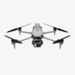
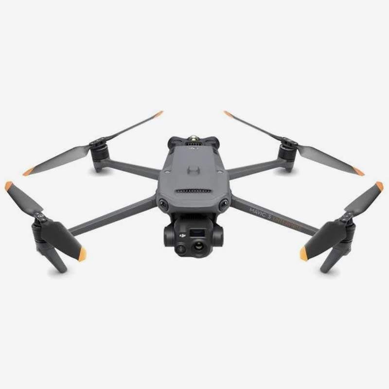
DJI Matrice 4T
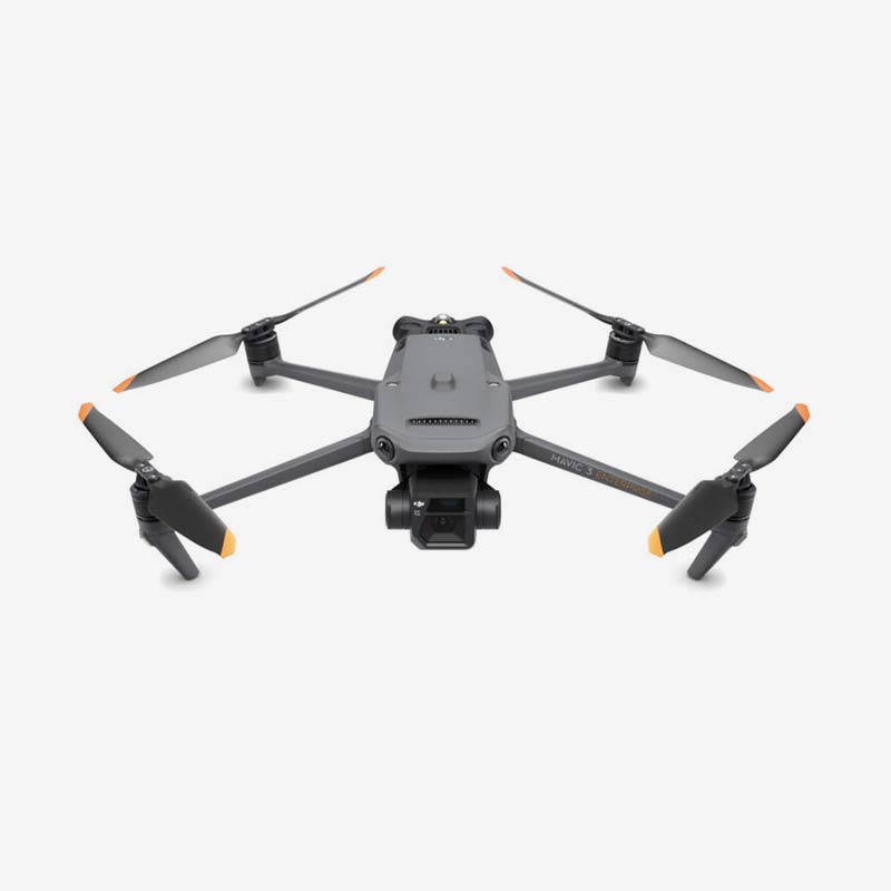
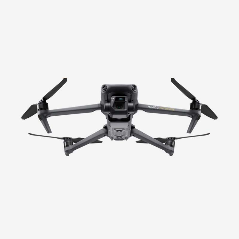
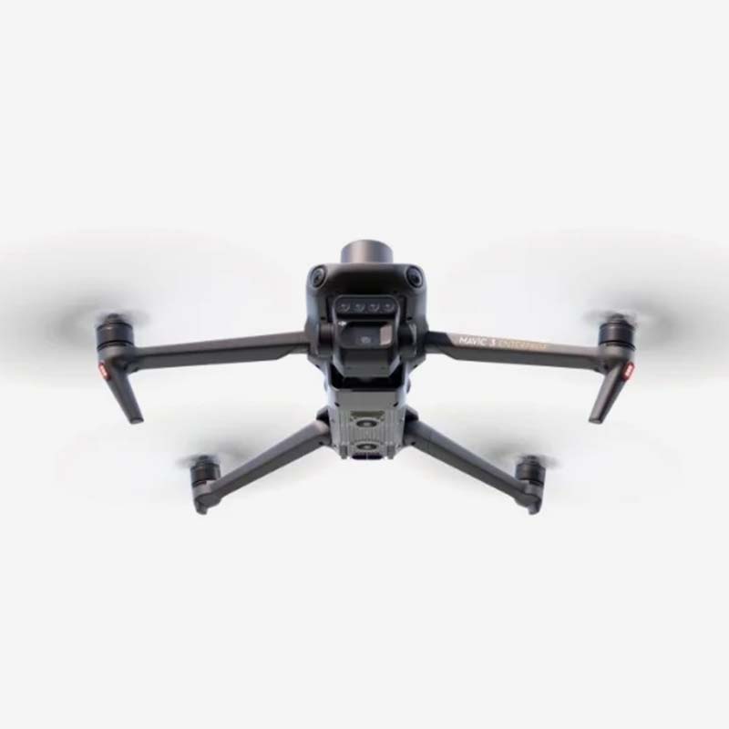
DJI Mavic 3 Enterprise
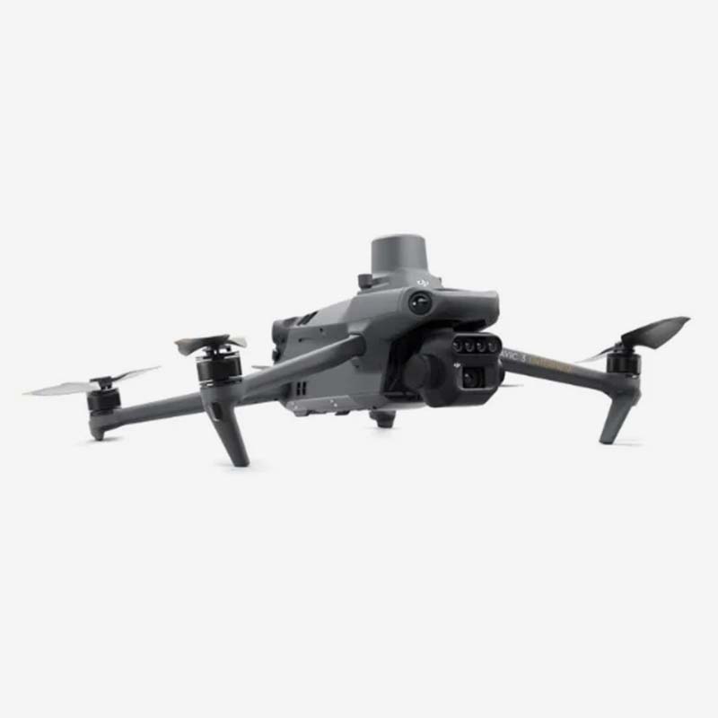
DJI Mavic 3 Multispectral
DJI Mavic 3 Thermal

Reviews
There are no reviews yet.