


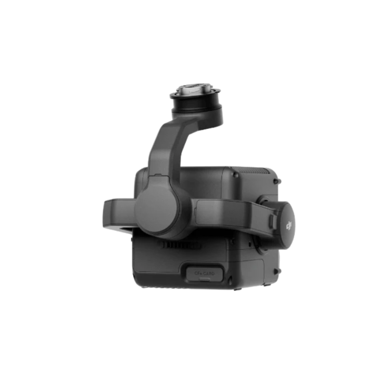


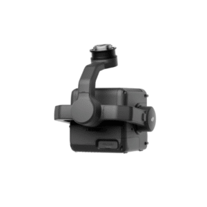

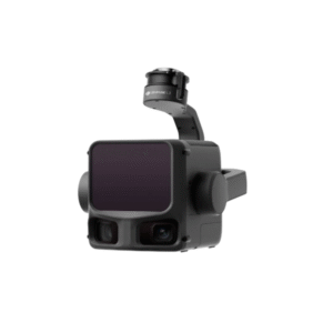
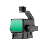
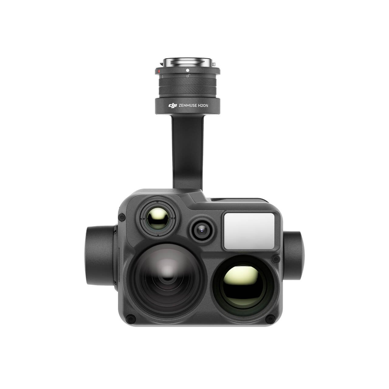
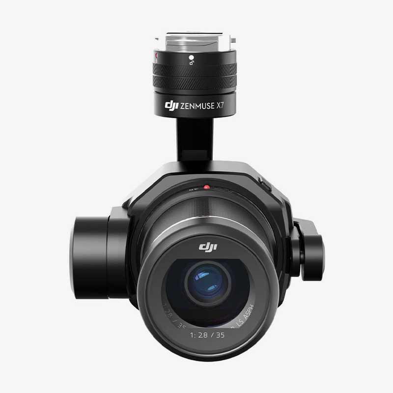
Zenmuse L3
₹142,500.00 Original price was: ₹142,500.00.₹136,499.00Current price is: ₹136,499.00. incl. Gst
Product Type: LiDAR + RGB Mapping System
Weight: 1.60 kg
Dimensions: 192×162×202 mm
Power: 64 W (typical), 100 W (max)
Protection Rating: IP54
Operating Temperature: -20°C to 50°C
Accuracy at 120 m: Vertical 3 cm, Horizontal 4 cm
Accuracy at 300 m: Vertical 5 cm, Horizontal 7.5 cm
Detection Range: Up to 2000 m
Laser Wavelength: 1535 nm
Laser Safety: Class 1
Sensor: 4/3 CMOS, 100 MP
Lens: 28 mm, f/2.0–f/11
Video Resolution: 4K@30fps
Gimbal: 3-axis, ±0.01° accuracy
Positioning: RTK-enabled, Horizontal 1 cm + 1 ppm
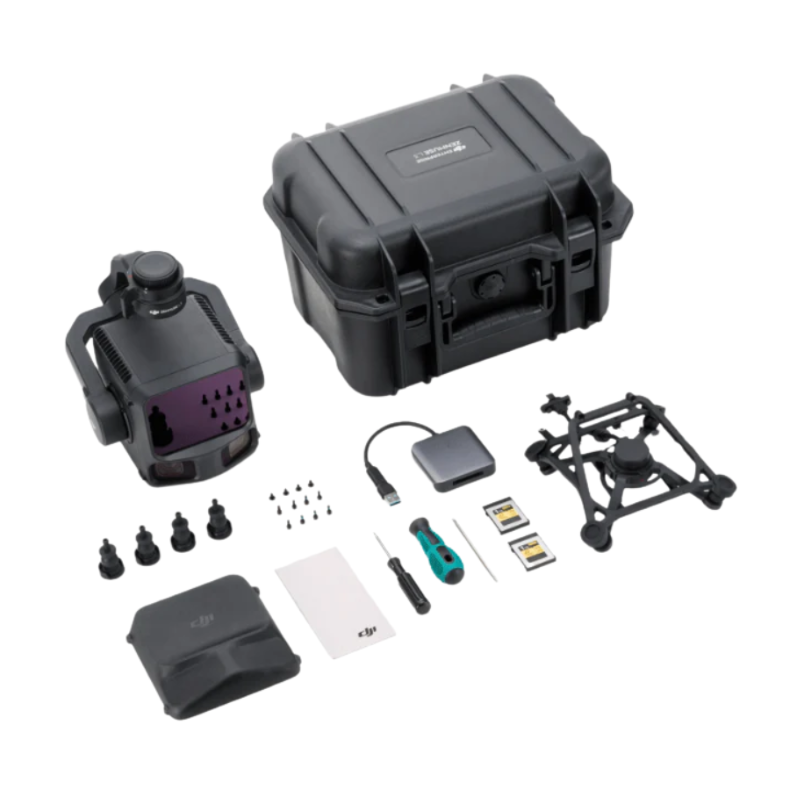
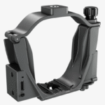
Supported Drone: DJI Matrice 400
Software: DJI Pilot 2, DJI Terra, DJI Modify, FlightHub 2
Need Help? Chat with an Expert
- 9891098328
Free Shipping & Returns
Assured Quality
Online Support 24/7
Secure Payment
- Description
- Specification
- Reviews (0)
Description
DJI Zenmuse L3 – Precision LiDAR Meets Power of Vision
The DJI Zenmuse L3 is not just another aerial sensor—it’s a powerhouse of laser precision and visual intelligence designed for professional mapping, surveying, and 3D modeling. Built for the DJI Matrice 400, it combines high-accuracy LiDAR technology with a 100MP RGB camera, giving you crystal-clear point clouds and rich imaging data in a single flight. Whether you’re mapping cityscapes, forests, or utility lines, the L3 delivers the kind of accuracy that turns “almost perfect” into “exactly right.”
Key Features
1. Dual Power: LiDAR + RGB Mapping in One
The Zenmuse L3 smartly merges LiDAR scanning and RGB imaging to create detailed, colorized 3D maps in one seamless workflow. The LiDAR system detects distances and shapes, while the 100MP RGB camera adds true color to every point cloud. This powerful duo means you don’t need two separate payloads—saving time, effort, and battery life during missions. For surveyors and inspection teams, it’s like having a laser scientist and a photographer working together mid-air.
2. Outstanding Accuracy That Never Misses a Beat
When you’re mapping from the sky, every centimeter counts. At 120 meters, the L3 achieves an impressive vertical accuracy of 3 cm and horizontal accuracy of 4 cm. Even at 300 meters, it maintains 5 cm vertical and 7.5 cm horizontal precision. These results come from advanced calibration, real-time IMU data, and DJI’s flight algorithms. In short, whether you’re scanning a rooftop or a mountain, you can trust the data down to the centimeter.
3. Unbelievable Detection Range for Any Terrain
With a detection range of up to 2000 meters (at 80% reflectivity), the Zenmuse L3 can handle long-distance scans like a pro. It adjusts its pulse rate automatically for optimal range, ensuring high-quality data even under bright sunlight or complex lighting conditions. From dense forests to shiny metal structures, the L3 keeps its eyes sharp—no area left unseen, no detail left unscanned.
4. Advanced Laser Precision and Safety
The L3 uses a 1535 nm laser wavelength—a class 1 eye-safe beam that ensures accuracy without safety risks. Its 0.25 mrad divergence produces a tight laser spot for sharp point clouds. With absolute ranging accuracy of ±10 mm, the system delivers clean and consistent results. Even the smallest wires or pole edges are detected clearly, helping surveyors map utilities with unmatched detail.
5. Three Powerful Scanning Modes
DJI knows one scanning pattern doesn’t fit all. That’s why the L3 offers Linear, Star-Shaped, and Non-Repetitive Scanning Modes. The Linear mode is great for straightforward mapping routes, while the Star and Non-Repetitive modes capture complex structures and uneven terrains with 80° × 80° coverage. So whether you’re scanning a flat construction site or a hilly forest, the L3 adapts like a professional cameraman who never misses an angle.
6. Incredible RGB Camera for Real-World Color
The integrated 4/3 CMOS 100MP RGB camera is not just there for looks—it’s there for accuracy. With a 28mm lens and an aperture range of f/2.0–f/11, it captures every shade and texture of your landscape. The camera supports 4K video recording at 30fps, allowing you to visualize your survey area in real-time. Each image aligns perfectly with LiDAR data, giving you detailed, colorized models ready for analysis or presentation.
7. Ultra-Precise Gimbal Stabilization
The L3’s 3-axis gimbal ensures total stability even in windy or high-speed conditions. With an angular accuracy of ±0.01°, your LiDAR and camera data remain perfectly aligned during flight. Its controllable pitch range from -120° to +60° lets you scan directly below or slightly forward as needed. The gimbal’s smooth motion guarantees that every scan remains crisp, stable, and beautifully structured.
8. Seamless RTK Positioning & Orientation System
Thanks to its advanced RTK-enabled POS system, the Zenmuse L3 achieves 1 cm horizontal and 1.5 cm vertical accuracy in positioning. The system continuously updates at 200 Hz, combining GNSS and IMU data for pinpoint geolocation. It means your mapping results won’t just be visually accurate—they’ll be geographically precise too. For professional surveyors, this makes ground control points almost unnecessary in many scenarios.
9. Built Tough for Every Mission
DJI built the Zenmuse L3 with an IP54-rated body, keeping it protected from dust and light rain. Operating between -20°C to 50°C, it’s ready for fieldwork in deserts, snowy mountains, or humid forests. Its compact 1.6 kg design ensures flight efficiency while maintaining balance and stability even on longer missions. Simply put, it’s tough enough to go wherever your data needs to go.
10. Smart Software Ecosystem
From flight planning to data processing, the L3 fits neatly into DJI’s professional workflow. Use DJI Pilot 2 for mission setup, DJI Terra for post-processing and point cloud optimization, and DJI Modify for editing and refining models. If you prefer cloud management, DJI FlightHub 2 keeps your team connected with real-time data sharing and analysis. The system supports multiple output formats like LAS, LAZ, PLY, PCD, and S3MB, making integration with industry software effortless.
How to Use
-
Mount the Zenmuse L3 securely on the DJI Matrice 400 using the SkyPort connector.
-
Power on the drone and open DJI Pilot 2 to plan your mapping route.
-
Choose the desired scanning mode (Linear, Star, or Non-Repetitive) based on your terrain.
-
Start your flight and let the L3 capture both LiDAR and RGB data simultaneously.
-
Import data into DJI Terra for processing and point cloud optimization.
How to Clean
-
Use a soft microfiber cloth to wipe the lens and LiDAR window gently.
-
Avoid harsh chemicals; use lens-safe cleaning solutions only.
-
Blow away dust with an air blower instead of wiping it dry.
-
Clean the gimbal joints with a soft brush to prevent dust buildup.
-
Always cover the lens and LiDAR area after use to protect from moisture or scratches.
How to Take Care
-
Store the payload in a dry, dust-free case after every use.
-
Avoid exposure to direct sunlight when not in operation.
-
Ensure firmware updates are regularly installed for optimal performance.
-
Handle the gimbal with care—never force it manually.
-
Do not operate during heavy rain or near reflective surfaces that can distort LiDAR readings.
Final Words
The DJI Zenmuse L3 is where engineering brilliance meets surveying mastery. It’s accurate, smart, and built for professionals who take precision seriously. Whether you’re mapping powerlines, construction sites, or natural landscapes, the L3 ensures your data is sharp, rich, and ready to impress clients. If your goal is to deliver world-class mapping with minimal rework, this is the sensor that guarantees results every single time.
System Specifications
| Specification | Details |
|---|---|
| Product Name | Zenmuse L3 |
| Point Cloud System Accuracy (At 120m Flight Altitude) | Vertical Accuracy: 3 cm (RMSE) Horizontal Accuracy: 4 cm (RMSE) |
| Point Cloud System Accuracy (At 300m Flight Altitude) | Vertical Accuracy: 5 cm (RMSE) Horizontal Accuracy: 7.5 cm (RMSE) |
| Measured Under the Following Conditions | 1. The field contained objects with obvious angular features. DJI Matrice 400 was linked to a position-calibrated D-RTK 3 Multifunctional Station. 2. The flight route was planned using DJI Pilot 2’s Area Route (with Calibrate IMU enabled) with Linear scanning. 3. The flight speed was set to 15 m/s, gimbal pitch to -90°, and each straight segment of the flight route was less than 3300 m. 4. Using exposed hard ground checkpoints that conformed to the diffuse reflection model. 5. DJI Terra was used for post-processing with Optimize Point Cloud Accuracy enabled. |
| Point Cloud Thickness | 1.2 cm @1σ (120m nadir flight altitude) 2 cm @1σ (300m nadir flight altitude) For 6σ, multiply the listed thickness by 6. |
| Measured Conditions (for Point Cloud Thickness) | Measured in Linear scanning mode, using check points on 80% reflectivity objects, with neither point cloud optimization nor downsampling enabled in DJI Terra. |
| Combined Horizontal FOV (Dual RGB Mapping Cameras) | 107° Composed by merging images from two cameras with a 45° optical axis angle between them. |
| RGB Ground Sampling Distance (GSD) | Average Value: 3 cm (300m nadir flight altitude) For detailed calculation methods, refer to the user manual available on the Downloads page of the official DJI Zenmuse L3 webpage. |
| Weight | 1.60 kg (without single gimbal connector) The Zenmuse L3 single gimbal connector weighs 145 g. |
| Dimensions | 192×162×202 mm (L×W×H) Measured in the default stabilized state after power-on with non-orthogonal gimbal design. |
| Power | 64 W (typical) 100 W (max) |
| Supported Aircraft | DJI Matrice 400 (requires the Zenmuse L3 single gimbal connector) |
| Ingress Protection Rating | IP54 |
| Operating Temperature | -20° to 50° C (-4° to 122° F) |
| Storage Temperature | -40° to 70° C (-40° to 158° F) |
LiDAR
| Specification | Details |
|---|---|
| Laser Wavelength | 1535 nm |
| Laser Beam Divergence | 0.25 mrad (1/e²) |
| Laser Spot Size | Φ 41 mm@120 m (1/e²) Φ 86 mm@300 m (1/e²) |
| Detection Range | 700 m@10% reflectivity, 350 kHz 950 m@10% reflectivity, 100 kHz 2000 m@80% reflectivity, 100 kHz |
| 1. Range Definition | The range is defined as the distance at which 50% of the emitted laser pulses are detected. If a laser beam hits more than one subject, the total laser transmitter power is split and the achievable range is reduced. |
| 2. Test Conditions | 100 klx ambient light, within the central area of the FOV, using a flat subject with a size larger than the laser beam diameter, a perpendicular angle of incidence, and an atmospheric visibility of 23 km. |
| 3. The maximum detection range | 900 m by default. For a longer range, contact DJI support or an authorized dealer. |
| Wire Detection Range | 21.6mm Steel Core Aluminum Stranded Wire: 300 m@100 klx, 350 kHz 18.4mm Black PVC Insulated Wire: 100 m@100 klx, 350 kHz |
| 1. Range Definition | The distance at which a fully scanned section of wire in mapping achieves a point density of 4 points per meter. |
| 2. Test Conditions | 100 klx ambient light, 23km atmospheric visibility, LiDAR center FOV perpendicular to the wire, Non-Repetitive scanning mode, drone flying along the wire at 15 m/s, and the wire is clean and not aged. |
| Ranging Accuracy | Absolute Accuracy: ±10 mm Repeatability: < 5 mm (1σ) |
| The above specifications can be met under test conditions | 25° C (77° F) ambient temperature, 350 kHz pulse rate, 80% object reflectivity, and distances of 120 m and 300 m. The actual environment may differ from the testing environment. The figure listed is for reference only. |
| Minimum Effective Detection Distance | 10 m |
| Laser Pulse Emission Frequency | 100 kHz, recommended flight altitude < 500 m 350 kHz, recommended flight altitude < 300 m 1000 kHz, recommended flight altitude < 100 m 2000 kHz, recommended flight altitude < 50 m |
| Number of Returns | 4, 8, 16 returns (100 kHz, 350 kHz) 4, 8 returns (1000 kHz) 4 returns (2000 kHz) |
| Cross-Cycle Calculation | 7 times |
| Scanning Mode and FOV | Linear Scanning Mode: Horizontal 80°, vertical 3° Star-Shaped Scanning Mode: Horizontal 80°, vertical 80° Non-Repetitive Scanning Mode: Horizontal 80°, vertical 80° |
| Laser Safety Classification | Class 1 (IEC 60825-1:2014) |
RGB Mapping Camera
| Specification | Details |
|---|---|
| Sensor | 4/3 CMOS |
| Lens | Equivalent Focal Length: 28 mm FOV: 73.3° (diagonal), 62° (horizontal), 41.2° (vertical) Aperture: f/2.0 – f/11 |
| Shutter | Mechanical Shutter: 2 – 1/1500 s (f/2.0), 2 – 1/2000 s (f/2.8 – f/11) Shutter Count: 500,000 Electronic Shutter: 2 – 1/16000 s |
| Photo Size | 100 MP: 12288 × 8192 25 MP: 6144 × 4096 |
| Minimum Photo Interval | JPEG: 25 MP: 0.5 s 100 MP: 1 s RAW or JPEG + RAW: 1.2 s |
| Video Specification | Video Format: MP4 (MPEG-4 HEVC/H.265) Resolution: 4K: 3840 × 2160 @30fps FHD: 1920 × 1080 @30fps |
Position and Orientation System (POS)
| Specification | Details |
|---|---|
| GNSS Update Rate | 5 Hz |
| POS Update Rate | 200 Hz |
| Attitude Error | Yaw Angle: 0.02° (post-processed, 1σ) Pitch/Roll Angle: 0.01° (post-processed, 1σ) |
| Positioning Accuracy | Horizontal Accuracy: 1.0 cm + 1 ppm (RTK fix) Vertical Accuracy: 1.5 cm + 1 ppm (RTK fix) |
| Supported PPK Differential Data Formats | DAT: Generated in Base Station Mode by D-RTK 3 Multifunctional Station and D-RTK 2 RINEX: v2.1x, v3.0x RTCM: v3.0, v3.1, v3.2, v3.3 (protocols: MSM3, MSM4, MSM5, MSM6, MSM7) OEM: OEM4, OEM6 |
| Field Operation Conditions | Ensure the distance between the Multifunctional Station and the aircraft does not exceed 15 km, and the Multifunctional Station supports satellite observation with more than two GNSS constellations. |
Gimbal
| Specification | Details |
|---|---|
| Degrees of Freedom | 3-axis (pitch, roll, yaw) |
| Angular Accuracy | ±0.01° |
| Mechanical Range | Pitch: -135° to +73° Roll: -90° to +60° Yaw: -105° to +105° Structural limit, not controllable range. |
| Controllable Range | Pitch: -120° to +60° Yaw: -80° to +80° Roll is uncontrollable, for stabilization only. |
| Self-Check Method | Roll Axis: Self-check not required Yaw Axis: Checks using limit stop Pitch Axis: Self-check not required |
| Mounting Method | Detachable DJI SKYPORT (Zenmuse L3 single gimbal connector) |
Data Storage
| Specification | Description |
|---|---|
| Raw Data Storage | Photo/IMU/Point cloud/GNSS/Calibration files |
| Standard Memory Card | CFexpress™ Type B Memory Card, sequential write speed 1500 MB/s |
| Standard Card Reader | Read/write speed > 900 MB/s |
Software Ecosystem
| Specification | Description |
|---|---|
| Data Collection | DJI Pilot 2 |
| Data Processing | DJI Terra |
| Data Application | DJI Modify |
| Cloud Application | DJI FlightHub 2 |
| Data Format | DJI Terra supports exporting point cloud models in the following formats: PNTS/LAS/LAZ/PLY/PCD/S3MB. DJI Modify supports importing point cloud models in the following formats: LAS |
Be the first to review “Zenmuse L3” Cancel reply
Overview
DJI Zenmuse L3 – Precision LiDAR Meets Power of Vision
The DJI Zenmuse L3 is not just another aerial sensor—it’s a powerhouse of laser precision and visual intelligence designed for professional mapping, surveying, and 3D modeling. Built for the DJI Matrice 400, it combines high-accuracy LiDAR technology with a 100MP RGB camera, giving you crystal-clear point clouds and rich imaging data in a single flight. Whether you’re mapping cityscapes, forests, or utility lines, the L3 delivers the kind of accuracy that turns “almost perfect” into “exactly right.”
Key Features
1. Dual Power: LiDAR + RGB Mapping in One
The Zenmuse L3 smartly merges LiDAR scanning and RGB imaging to create detailed, colorized 3D maps in one seamless workflow. The LiDAR system detects distances and shapes, while the 100MP RGB camera adds true color to every point cloud. This powerful duo means you don’t need two separate payloads—saving time, effort, and battery life during missions. For surveyors and inspection teams, it’s like having a laser scientist and a photographer working together mid-air.
2. Outstanding Accuracy That Never Misses a Beat
When you’re mapping from the sky, every centimeter counts. At 120 meters, the L3 achieves an impressive vertical accuracy of 3 cm and horizontal accuracy of 4 cm. Even at 300 meters, it maintains 5 cm vertical and 7.5 cm horizontal precision. These results come from advanced calibration, real-time IMU data, and DJI’s flight algorithms. In short, whether you’re scanning a rooftop or a mountain, you can trust the data down to the centimeter.
3. Unbelievable Detection Range for Any Terrain
With a detection range of up to 2000 meters (at 80% reflectivity), the Zenmuse L3 can handle long-distance scans like a pro. It adjusts its pulse rate automatically for optimal range, ensuring high-quality data even under bright sunlight or complex lighting conditions. From dense forests to shiny metal structures, the L3 keeps its eyes sharp—no area left unseen, no detail left unscanned.
4. Advanced Laser Precision and Safety
The L3 uses a 1535 nm laser wavelength—a class 1 eye-safe beam that ensures accuracy without safety risks. Its 0.25 mrad divergence produces a tight laser spot for sharp point clouds. With absolute ranging accuracy of ±10 mm, the system delivers clean and consistent results. Even the smallest wires or pole edges are detected clearly, helping surveyors map utilities with unmatched detail.
5. Three Powerful Scanning Modes
DJI knows one scanning pattern doesn’t fit all. That’s why the L3 offers Linear, Star-Shaped, and Non-Repetitive Scanning Modes. The Linear mode is great for straightforward mapping routes, while the Star and Non-Repetitive modes capture complex structures and uneven terrains with 80° × 80° coverage. So whether you’re scanning a flat construction site or a hilly forest, the L3 adapts like a professional cameraman who never misses an angle.
6. Incredible RGB Camera for Real-World Color
The integrated 4/3 CMOS 100MP RGB camera is not just there for looks—it’s there for accuracy. With a 28mm lens and an aperture range of f/2.0–f/11, it captures every shade and texture of your landscape. The camera supports 4K video recording at 30fps, allowing you to visualize your survey area in real-time. Each image aligns perfectly with LiDAR data, giving you detailed, colorized models ready for analysis or presentation.
7. Ultra-Precise Gimbal Stabilization
The L3’s 3-axis gimbal ensures total stability even in windy or high-speed conditions. With an angular accuracy of ±0.01°, your LiDAR and camera data remain perfectly aligned during flight. Its controllable pitch range from -120° to +60° lets you scan directly below or slightly forward as needed. The gimbal’s smooth motion guarantees that every scan remains crisp, stable, and beautifully structured.
8. Seamless RTK Positioning & Orientation System
Thanks to its advanced RTK-enabled POS system, the Zenmuse L3 achieves 1 cm horizontal and 1.5 cm vertical accuracy in positioning. The system continuously updates at 200 Hz, combining GNSS and IMU data for pinpoint geolocation. It means your mapping results won’t just be visually accurate—they’ll be geographically precise too. For professional surveyors, this makes ground control points almost unnecessary in many scenarios.
9. Built Tough for Every Mission
DJI built the Zenmuse L3 with an IP54-rated body, keeping it protected from dust and light rain. Operating between -20°C to 50°C, it’s ready for fieldwork in deserts, snowy mountains, or humid forests. Its compact 1.6 kg design ensures flight efficiency while maintaining balance and stability even on longer missions. Simply put, it’s tough enough to go wherever your data needs to go.
10. Smart Software Ecosystem
From flight planning to data processing, the L3 fits neatly into DJI’s professional workflow. Use DJI Pilot 2 for mission setup, DJI Terra for post-processing and point cloud optimization, and DJI Modify for editing and refining models. If you prefer cloud management, DJI FlightHub 2 keeps your team connected with real-time data sharing and analysis. The system supports multiple output formats like LAS, LAZ, PLY, PCD, and S3MB, making integration with industry software effortless.
How to Use
-
Mount the Zenmuse L3 securely on the DJI Matrice 400 using the SkyPort connector.
-
Power on the drone and open DJI Pilot 2 to plan your mapping route.
-
Choose the desired scanning mode (Linear, Star, or Non-Repetitive) based on your terrain.
-
Start your flight and let the L3 capture both LiDAR and RGB data simultaneously.
-
Import data into DJI Terra for processing and point cloud optimization.
How to Clean
-
Use a soft microfiber cloth to wipe the lens and LiDAR window gently.
-
Avoid harsh chemicals; use lens-safe cleaning solutions only.
-
Blow away dust with an air blower instead of wiping it dry.
-
Clean the gimbal joints with a soft brush to prevent dust buildup.
-
Always cover the lens and LiDAR area after use to protect from moisture or scratches.
How to Take Care
-
Store the payload in a dry, dust-free case after every use.
-
Avoid exposure to direct sunlight when not in operation.
-
Ensure firmware updates are regularly installed for optimal performance.
-
Handle the gimbal with care—never force it manually.
-
Do not operate during heavy rain or near reflective surfaces that can distort LiDAR readings.
Final Words
The DJI Zenmuse L3 is where engineering brilliance meets surveying mastery. It’s accurate, smart, and built for professionals who take precision seriously. Whether you’re mapping powerlines, construction sites, or natural landscapes, the L3 ensures your data is sharp, rich, and ready to impress clients. If your goal is to deliver world-class mapping with minimal rework, this is the sensor that guarantees results every single time.


Reviews
There are no reviews yet.