


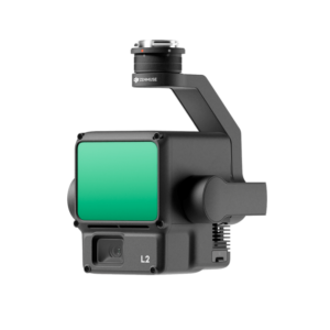
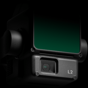

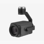
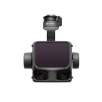
Zenmuse-l2
- High Accuracy LiDAR – Vertical accuracy of 4 cm, horizontal accuracy of 5 cm.
- Extended Detection Range – Detects objects up to 250 m (10% reflectivity) and 450 m (50% reflectivity).
- Dense Point Cloud – Captures 240,000 points per second for detailed 3D modeling.
- Multi-Return Capability – Supports up to 5 returns for superior penetration through vegetation.
- Integrated RGB Camera – 20 MP 4/3 CMOS sensor with a mechanical shutter.
- Fast & Efficient Coverage – Maps up to 2.5 km² in a single flight.
- Advanced IMU System – High-precision real-time positioning with RTK FIX support.
- Wide Field of View – 70.4° (horizontal) x 4.5° (vertical) coverage.
- Rugged & Weatherproof – IP54-rated, dust and water-resistant for tough environments.
- Seamless DJI Integration – Compatible with Matrice 300 RTK & Matrice 350 RTK, works with DJI Terra for post-processing.
Need Help? Chat with an Expert
- 9891098328
Free Shipping & Returns
Assured Quality
Online Support 24/7
Secure Payment
- Description
- Specifications
- Reviews (0)
Description
DJI Zenmuse L2 – The Next-Level Lidar Solution for Aerial Mapping!
If you’ve ever wished for a magical laser scanner that maps the world with pinpoint accuracy, the DJI Zenmuse L2 is here to make that wish come true! Packed with cutting-edge Lidar technology, this sensor takes aerial surveying, 3D mapping, and terrain modeling to the next level. Whether you’re a GIS professional, construction planner, or environmental researcher, the L2 delivers ultra-precise, real-time 3D data with unmatched efficiency and accuracy. It’s not just a camera—it’s a game-changing tool for serious professionals who want the best geospatial data without the hassle.
Why the Zenmuse L2 is the Ultimate Lidar Sensor for Drones
1. High-Precision Lidar Scanning – Capture Every Detail!
The Zenmuse L2 features an advanced Lidar sensor with a 240,000-point-per-second sampling rate, allowing it to capture even the finest details of terrain, vegetation, and structures with extreme accuracy. Whether you’re mapping dense forests, uneven landscapes, or urban environments, the L2 ensures you get clean, high-resolution 3D models with minimal noise and maximum clarity. Say goodbye to inaccurate elevation models and hello to precision data!
2. Longer Detection Range – See Farther, Scan Faster!
Need to scan large areas without multiple flights? The Zenmuse L2 has an incredible 450-meter detection range at 50% reflectivity, allowing you to cover vast areas in a single flight. Whether you’re surveying mountainous regions, agricultural fields, or large infrastructure projects, this sensor ensures you collect more data in less time, improving efficiency like never before.
3. High-Accuracy IMU System – No More Guesswork!
What good is Lidar data if it’s not perfectly aligned? The L2’s upgraded Inertial Measurement Unit (IMU) works alongside RTK (Real-Time Kinematic) positioning to deliver centimeter-level accuracy. That means no misaligned point clouds, no messy data, and no headaches during post-processing. Just drop the files into your software, and you’re ready to create flawless 3D models.
4. Integrated 20MP RGB Camera – Lidar with True-Color Imaging!
Lidar scans are great, but what if you also need high-resolution visual data? The Zenmuse L2 solves that problem by integrating a 20MP RGB camera with a 4/3-inch CMOS sensor, ensuring that your point clouds come with stunning, color-accurate textures. This means you get not just accurate 3D data, but also beautiful photorealistic reconstructions—perfect for detailed inspections, land planning, and high-end geospatial analysis.
5. Improved Penetration Through Vegetation – See the Ground Like Never Before!
If you’ve ever struggled with mapping forested areas where the ground is hidden beneath thick vegetation, the Zenmuse L2 is your best friend. Its laser pulses penetrate through tree canopies, allowing you to generate highly detailed Digital Terrain Models (DTMs) that reveal hidden topography, elevation changes, and geological features beneath the foliage. Whether you’re working in forestry, archaeology, or environmental monitoring, the L2 ensures you see the ground as it truly is.
6. One-Click Point Cloud Processing – Simplify Your Workflow!
Gone are the days of spending hours cleaning up messy Lidar data. With DJI’s advanced One-Click Processing feature, the L2 automatically filters and processes point clouds in real-time, ensuring you get usable data straight out of the box. Whether you need to generate digital elevation models, conduct volumetric measurements, or create 3D city models, the L2 makes it effortless and efficient.
How to Use the ZENMUSE L2
-
Mount It Like a Precision Engineer
Attach the Zenmuse L2 to your DJI drone with care—this isn’t a cheap action camera, it’s a high-tech LiDAR sensor! Ensure it’s locked in place so it doesn’t decide to take an independent flight of its own. -
Calibrate for Laser Accuracy
Fire up the DJI Pilot app and run the calibration. This ensures your LiDAR scans are crisp and accurate, not looking like a toddler’s crayon drawing. Let the drone do its fancy self-checks before you take off. -
Adjust Settings Like a Pro
Whether you’re mapping a dense forest or inspecting infrastructure, fine-tune the scan resolution and point cloud density to match your needs. Don’t just max out the settings unless you want your data processing time to stretch into next year. -
Fly Smooth, Scan Smarter
The L2 is a laser wizard, but it prefers stable flights. Keep your drone steady—sudden jerks and wild maneuvers might make your scan look like a glitchy video game. Smooth flying equals detailed, usable 3D models. -
Check Your Data Before Landing
Before bringing the drone back down, review the LiDAR scans to ensure you captured everything. Realizing you missed a spot after landing is like realizing you left your wallet at home after reaching the checkout counter.
How to Take Care of the ZENMUSE L2
-
Keep That Lens and Sensor Clean
The LiDAR sensor is your best friend—treat it with respect! Use a soft microfiber cloth to keep dust and smudges away. A dirty sensor means inaccurate scans, and nobody wants a 3D model that looks like a melted wax sculpture. -
Store It Like a Treasure
Keep the L2 in a well-padded case when not in use. Tossing it in your drone bag without protection is like throwing your phone into a pile of rocks—bad idea! -
Avoid the Rainy Day Blues
The L2 is built tough, but water and electronics still don’t mix well. Flying in heavy rain could lead to a very expensive regret. If the forecast looks bad, it’s Netflix-and-relax day, not drone-mapping day. -
Firmware Updates Are Your Friend
DJI releases updates to improve performance and fix bugs, so don’t ignore them. Updating your firmware is like taking your drone for a digital health check—it keeps things running smoothly. -
Pre-Flight Check, Every Time!
Before every flight, inspect for loose connections, cracks, or debris around the sensor. If something looks off, don’t take risks—fix it before sending your drone into the sky. A few minutes of checking can save you from a costly mid-air disaster.
Map Smarter, Work Faster, Capture Every Detail!
The DJI Zenmuse L2 is the ultimate Lidar solution for professionals who demand accuracy, efficiency, and ease of use. Whether you’re conducting land surveys, infrastructure inspections, forestry analysis, or archaeological mapping, the L2 provides high-precision 3D data in real-time, allowing you to see the world like never before.
Upgrade Your Mapping Game – Get the Zenmuse L2 Today!
Specification of DJI Zenmuse L2
| Category | Specifications |
|---|---|
| General | |
| Product Name | Zenmuse L2 |
| Dimensions (L×W×H) | 155 × 128 × 176 mm |
| Weight | Approx. 905 g |
| Power Consumption | 28 W (typical), 58 W (max) |
| IP Rating | IP54 (dust and water resistance) |
| Supported Aircraft | Matrice 300 RTK (DJI RC Plus required), Matrice 350 RTK |
| LiDAR Module | |
| Detection Range | Up to 250 m (10% reflectivity, 100 klx) / Up to 450 m (50% reflectivity, 0 klx) |
| Field of View (FOV) | 70.4° (horizontal) × 4.5° (vertical) |
| Point Cloud Rate | Up to 240,000 points per second |
| Laser Wavelength | 905 nm |
| Multi-Return Support | Up to 5 returns |
| Laser Spot Size | Approx. 4×12 cm at 100 m |
| IMU System | |
| Update Frequency | 200 Hz |
| Accelerometer Range | ±6 g |
| Angular Velocity Meter | ±300 dps |
| Horizontal Accuracy | RTK FIX: 1 cm + 1 ppm |
| Vertical Accuracy | RTK FIX: 1.5 cm + 1 ppm |
| RGB Mapping Camera | |
| Sensor | 4/3 CMOS, 20 MP |
| Lens | 24 mm equivalent, f/2.8–f/11, Autofocus (1 m to ∞) |
| Photo Resolution | 5280 × 3956 pixels |
| Shutter Speed | Mechanical: 2–1/2000 s, Electronic: 2–1/8000 s |
| ISO Range | 100–6400 (photo & video) |
| Video Resolution | 4K (3840×2160 @30fps), FHD (1920×1080 @30fps) |
| Software & Compatibility | |
| Data Processing | DJI Terra compatible |
| Storage Format | microSD (UHS-I Speed Grade 3 required) |
| Operating Temperature | -20°C to 50°C |
Be the first to review “Zenmuse-l2” Cancel reply
Overview
DJI Zenmuse L2 – The Next-Level Lidar Solution for Aerial Mapping!
If you’ve ever wished for a magical laser scanner that maps the world with pinpoint accuracy, the DJI Zenmuse L2 is here to make that wish come true! Packed with cutting-edge Lidar technology, this sensor takes aerial surveying, 3D mapping, and terrain modeling to the next level. Whether you’re a GIS professional, construction planner, or environmental researcher, the L2 delivers ultra-precise, real-time 3D data with unmatched efficiency and accuracy. It’s not just a camera—it’s a game-changing tool for serious professionals who want the best geospatial data without the hassle.
Why the Zenmuse L2 is the Ultimate Lidar Sensor for Drones
1. High-Precision Lidar Scanning – Capture Every Detail!
The Zenmuse L2 features an advanced Lidar sensor with a 240,000-point-per-second sampling rate, allowing it to capture even the finest details of terrain, vegetation, and structures with extreme accuracy. Whether you’re mapping dense forests, uneven landscapes, or urban environments, the L2 ensures you get clean, high-resolution 3D models with minimal noise and maximum clarity. Say goodbye to inaccurate elevation models and hello to precision data!
2. Longer Detection Range – See Farther, Scan Faster!
Need to scan large areas without multiple flights? The Zenmuse L2 has an incredible 450-meter detection range at 50% reflectivity, allowing you to cover vast areas in a single flight. Whether you’re surveying mountainous regions, agricultural fields, or large infrastructure projects, this sensor ensures you collect more data in less time, improving efficiency like never before.
3. High-Accuracy IMU System – No More Guesswork!
What good is Lidar data if it’s not perfectly aligned? The L2’s upgraded Inertial Measurement Unit (IMU) works alongside RTK (Real-Time Kinematic) positioning to deliver centimeter-level accuracy. That means no misaligned point clouds, no messy data, and no headaches during post-processing. Just drop the files into your software, and you’re ready to create flawless 3D models.
4. Integrated 20MP RGB Camera – Lidar with True-Color Imaging!
Lidar scans are great, but what if you also need high-resolution visual data? The Zenmuse L2 solves that problem by integrating a 20MP RGB camera with a 4/3-inch CMOS sensor, ensuring that your point clouds come with stunning, color-accurate textures. This means you get not just accurate 3D data, but also beautiful photorealistic reconstructions—perfect for detailed inspections, land planning, and high-end geospatial analysis.
5. Improved Penetration Through Vegetation – See the Ground Like Never Before!
If you’ve ever struggled with mapping forested areas where the ground is hidden beneath thick vegetation, the Zenmuse L2 is your best friend. Its laser pulses penetrate through tree canopies, allowing you to generate highly detailed Digital Terrain Models (DTMs) that reveal hidden topography, elevation changes, and geological features beneath the foliage. Whether you’re working in forestry, archaeology, or environmental monitoring, the L2 ensures you see the ground as it truly is.
6. One-Click Point Cloud Processing – Simplify Your Workflow!
Gone are the days of spending hours cleaning up messy Lidar data. With DJI’s advanced One-Click Processing feature, the L2 automatically filters and processes point clouds in real-time, ensuring you get usable data straight out of the box. Whether you need to generate digital elevation models, conduct volumetric measurements, or create 3D city models, the L2 makes it effortless and efficient.
How to Use the ZENMUSE L2
-
Mount It Like a Precision Engineer
Attach the Zenmuse L2 to your DJI drone with care—this isn’t a cheap action camera, it’s a high-tech LiDAR sensor! Ensure it’s locked in place so it doesn’t decide to take an independent flight of its own. -
Calibrate for Laser Accuracy
Fire up the DJI Pilot app and run the calibration. This ensures your LiDAR scans are crisp and accurate, not looking like a toddler’s crayon drawing. Let the drone do its fancy self-checks before you take off. -
Adjust Settings Like a Pro
Whether you’re mapping a dense forest or inspecting infrastructure, fine-tune the scan resolution and point cloud density to match your needs. Don’t just max out the settings unless you want your data processing time to stretch into next year. -
Fly Smooth, Scan Smarter
The L2 is a laser wizard, but it prefers stable flights. Keep your drone steady—sudden jerks and wild maneuvers might make your scan look like a glitchy video game. Smooth flying equals detailed, usable 3D models. -
Check Your Data Before Landing
Before bringing the drone back down, review the LiDAR scans to ensure you captured everything. Realizing you missed a spot after landing is like realizing you left your wallet at home after reaching the checkout counter.
How to Take Care of the ZENMUSE L2
-
Keep That Lens and Sensor Clean
The LiDAR sensor is your best friend—treat it with respect! Use a soft microfiber cloth to keep dust and smudges away. A dirty sensor means inaccurate scans, and nobody wants a 3D model that looks like a melted wax sculpture. -
Store It Like a Treasure
Keep the L2 in a well-padded case when not in use. Tossing it in your drone bag without protection is like throwing your phone into a pile of rocks—bad idea! -
Avoid the Rainy Day Blues
The L2 is built tough, but water and electronics still don’t mix well. Flying in heavy rain could lead to a very expensive regret. If the forecast looks bad, it’s Netflix-and-relax day, not drone-mapping day. -
Firmware Updates Are Your Friend
DJI releases updates to improve performance and fix bugs, so don’t ignore them. Updating your firmware is like taking your drone for a digital health check—it keeps things running smoothly. -
Pre-Flight Check, Every Time!
Before every flight, inspect for loose connections, cracks, or debris around the sensor. If something looks off, don’t take risks—fix it before sending your drone into the sky. A few minutes of checking can save you from a costly mid-air disaster.
Map Smarter, Work Faster, Capture Every Detail!
The DJI Zenmuse L2 is the ultimate Lidar solution for professionals who demand accuracy, efficiency, and ease of use. Whether you’re conducting land surveys, infrastructure inspections, forestry analysis, or archaeological mapping, the L2 provides high-precision 3D data in real-time, allowing you to see the world like never before.
Upgrade Your Mapping Game – Get the Zenmuse L2 Today!


Reviews
There are no reviews yet.